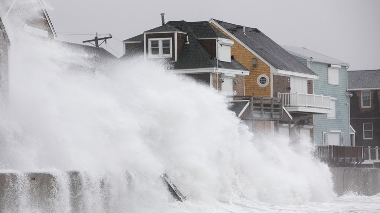
A major Nor’easter slammed the East Coast on Friday from Georgia to Maine, bringing heavy rain, severe flooding, snow and the threat of hurricane-force winds in some coastal areas.
The eastern seaboard braced for wind gusts exceeding 50 mph, with possible hurricane-strength winds of 80 to 90 mph on Cape Cod. Heavy snow fell from Ohio to upstate New York and on eastward.
Residents from Boston to Rhode island expected to receive 2 to 5 inches of snow.
High wind warnings were in effect along almost the entire Interstate 95 urban corridor from Boston to Washington D.C., bringing the threat of wind gusts to 60 mph.
At mid-morning, more than a half million customers were without power in the Mid-Atlantic, the Great Lakes, the Southeast and New England
Around Washington, D.C., downed power lines cut electricity to 170,000 people in Virginia, Maryland and the District. The federal government and several area school districts shut down for the day as gusts up to 50 mph knocked down trees in the region.
Nationwide, 2,130 flights were canceled and another 550 delayed as of 9:35 a.m. ET, according to flight-tracking service FlightAware.
Most of those cancellations were spread across airports in the Northeast, where wind gusts of up to 70 mph were possible. The winds were expected to have an unusually long duration, lasting into Saturday.
Some pre-emptive cancellations were already being reported for Saturday, with nearly 50 flights already grounded at airports across the Northeast and New England.
The change from rain to wet snow during the evening commute could cause travel issues in Pennsylvania from Harrisburg to Allentown and Philadelphia.
A nor'easter is a strong area of low pressure along the East Coast that draws wind from the northeast off the Atlantic. It is often associated with strong winter storms moving along the coast. This one is expected to last through early Saturday.
Based on a 24-hour pressure change of 114 millibars to 987 millibars, the powerful storm slamming the Northeast has officially undergone bombogenesis, according to AccuWeather Senior Meteorologist Alex Sosnowski.
"This 'bomb cyclone' wind field is larger than most Category 1 hurricanes, with winds to match," Meteorologist Ryan Maue of weather.us said.
The storm could take a chunk out of Jersey shore beaches still being repaired following damage from earlier storms.
In Massachusetts, Gov. Charlie Baker activated 200 National Guard members. In Duxbury, south of Boston, officials urged people to evacuate as soon as possible, and the fire department was preparing to use a high water rescue vehicle for the first time to help any residents who wind up stuck in homes during high floodwaters.
Michelle Shaffer, 45, of the coastal Massachusetts town of Hull, lost her appliances under 5 feet of water during the last big storm.
“I have a new washer, and my boyfriend just built a wooden platform for it. We got a couple of sump pumps,” said Shaffer, who evacuated to higher ground Thursday night. “This storm is going to be worse because it’s going over three high tides,” she said.
The Coast Guard advised boaters to exercise “vigilance and extreme caution.” The National Weather Service warned the storm would morph into heavier, wet snow later Friday.