
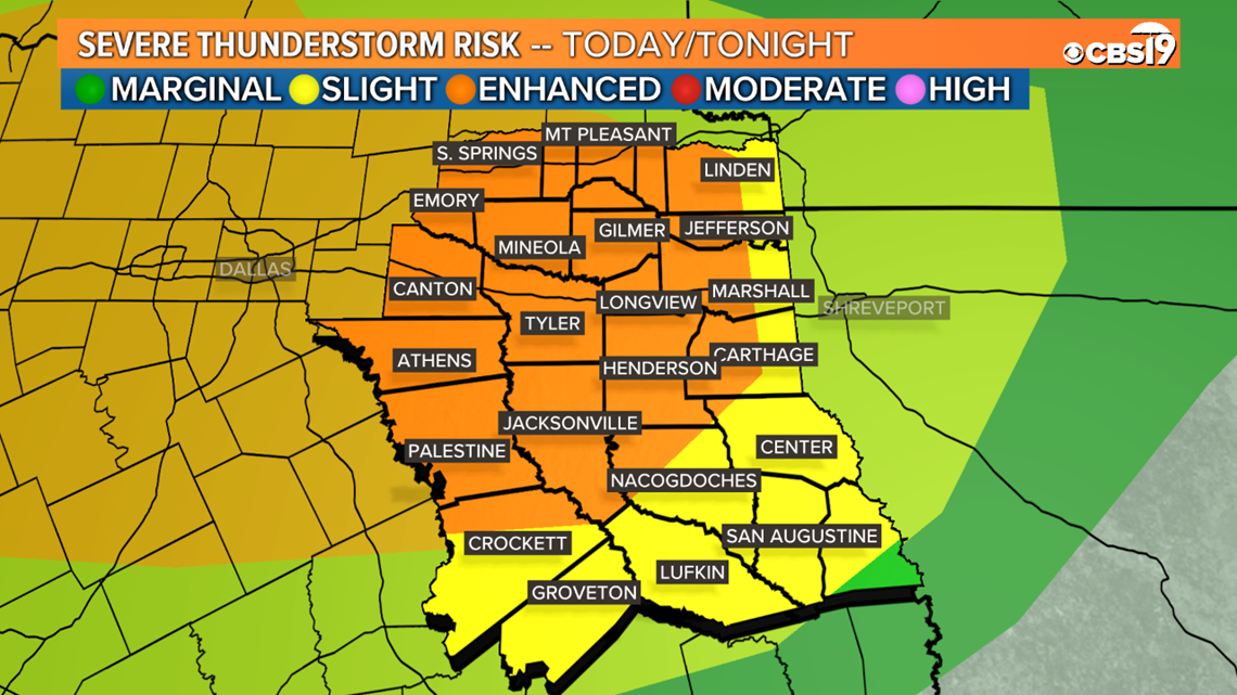
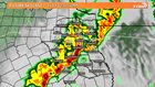
TYLER, Texas — Heading into Wednesday evening and overnight the odds of dealing with severe thunderstorms in our area looks more likely the not. The Storm Prediction Center has issued an Enhanced Risk for most of East Texas on Wednesday, including Tyler and Longview, with Nacogdoches & Lufkin, as well as our southern and eastern counties, being under a Slight Risk.
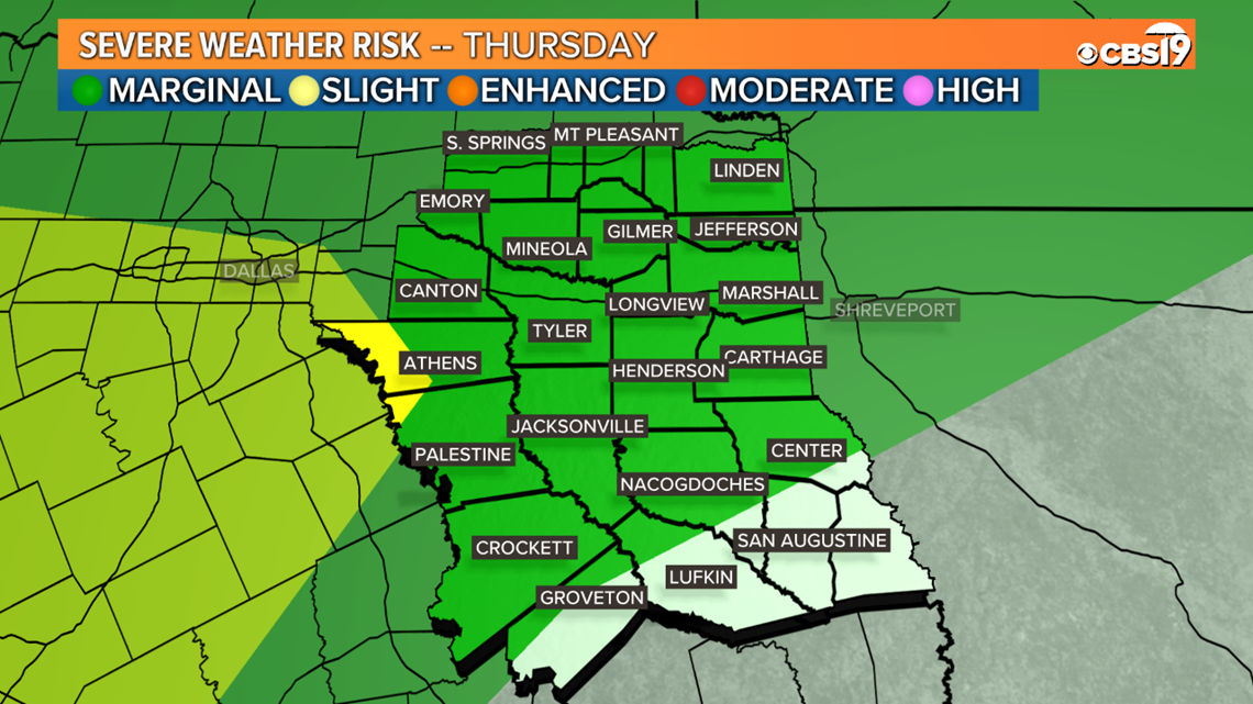
Additionally, all of East Texas is under a marginal risk for Thursday, but this too could be upgraded to a slight risk as well.
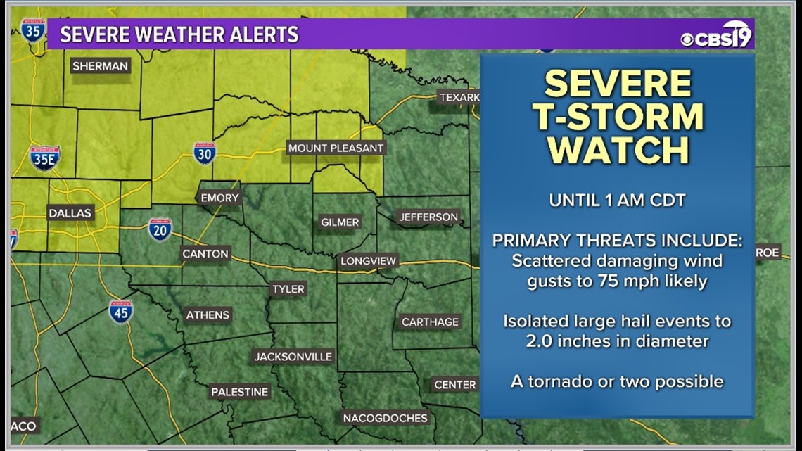
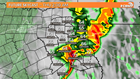
A SEVERE THUNDERSTORM WATCH has been issued until 1 AM for Hopkins, Franklin, Titus, Morris and Camp counties. Gusty winds and large hail will be the main threat, but a tornado or two is also possible. Stay weather aware East Texas.
Threats:
Damaging Wind and Heavy Rains look like the main concerns as a line of storms moves through late Wednesday evening, and even going into the overnight into early Thursday. The risk for a few tornadoes and large hail will also be present.


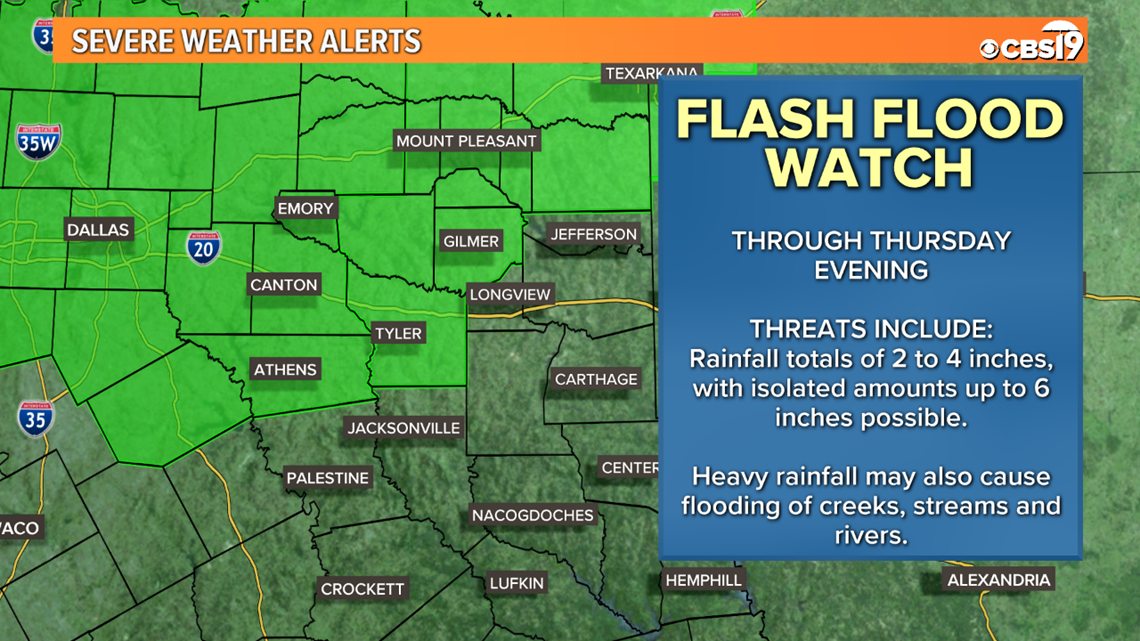
Heavy rain is likely to be a major impact with storms this week. Broad areas of 2 to 4 inches of rain are possible, with some areas locally seeing totals as high as 6 inches.

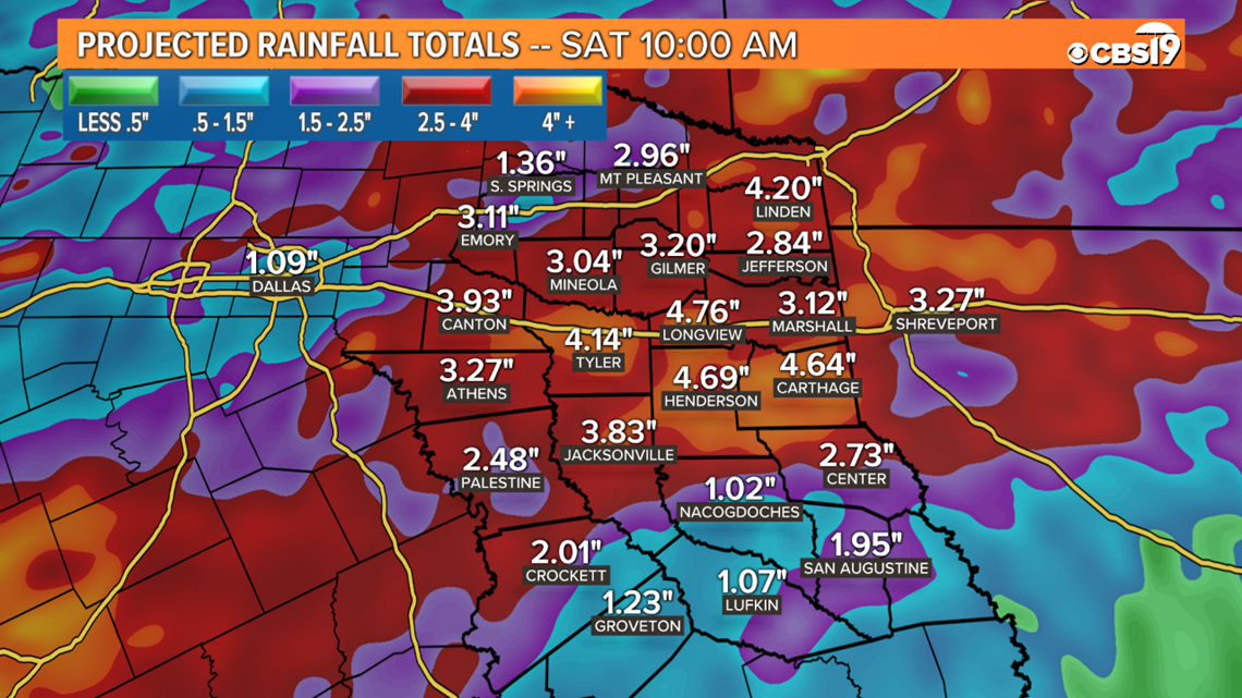
A Flash Flood Watch is in place for several counties around East Texas from now through Thursday night. This does include the city of Tyler. Remember, never drive through flooded roadways. Turn around, don't drown!

Reasoning:
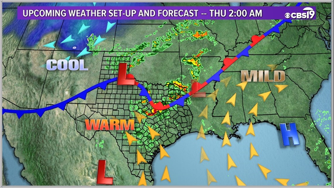
The reason storms are expected to stick around for several days is due to the set-up. A stationary front will hang around the region staring now and will not move out until the weekend. Along with the stationary front, dew points will be near 70° which will lead to torrential rainfall with these storms. As the front moves back and forth across East Texas, it will lead to several rounds of storms and possible severe weather on Wednesday, Thursday, and Friday.
Timing:
A line of strong to severe storms has formed out over central portions of Texas this afternoon. It is heading toward East Texas late this evening and into the overnight. This line of storms will primarily present a risk for damaging winds and heavy rains, but large hail and a few tornadoes remain realistic risk factors as well. These storms could last as late as the morning commute on Thursday.
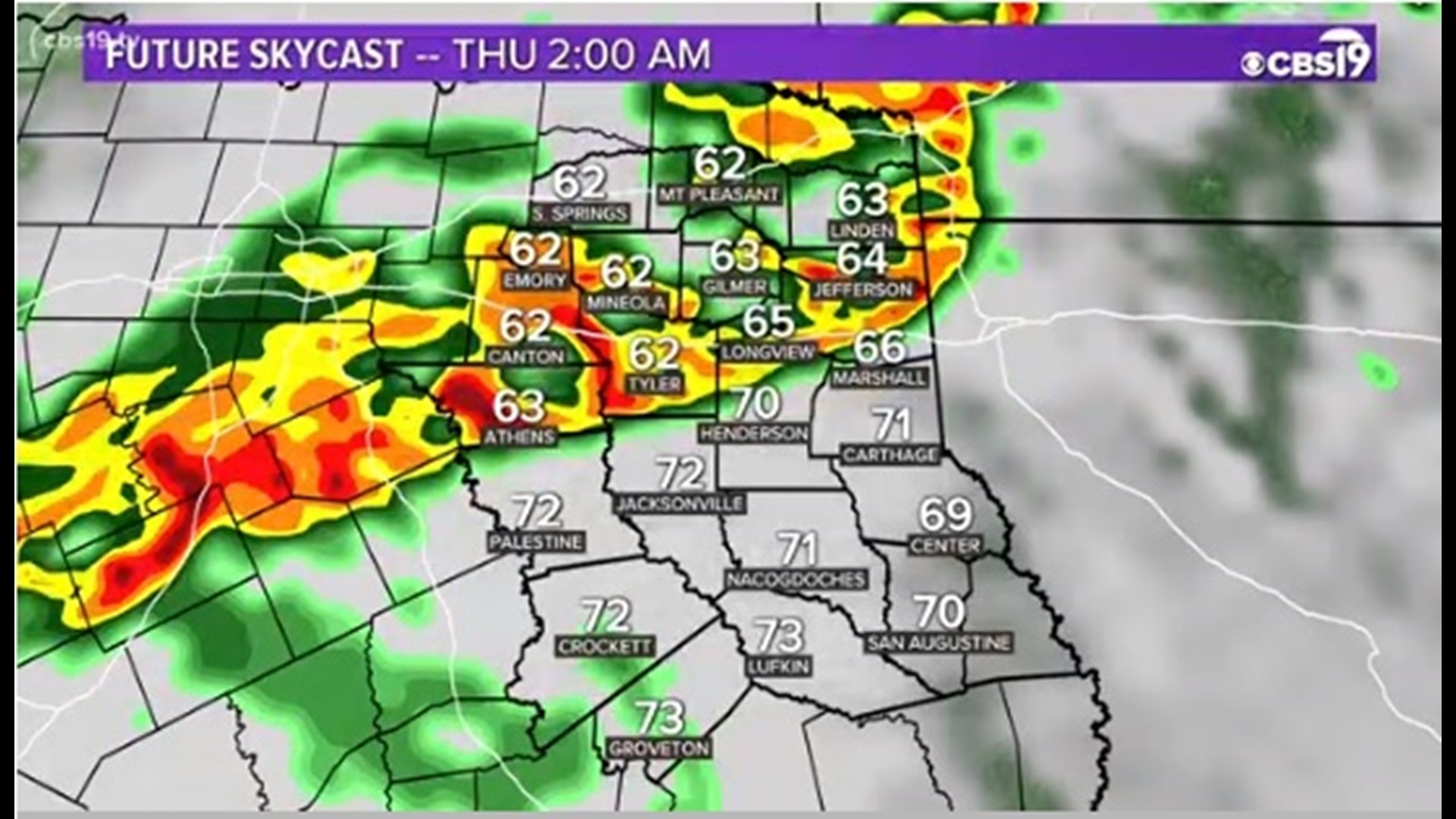
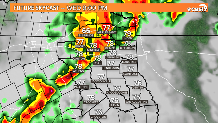
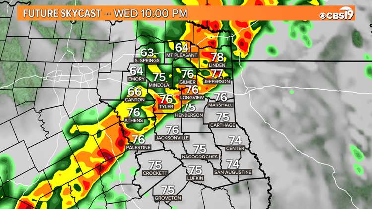
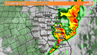
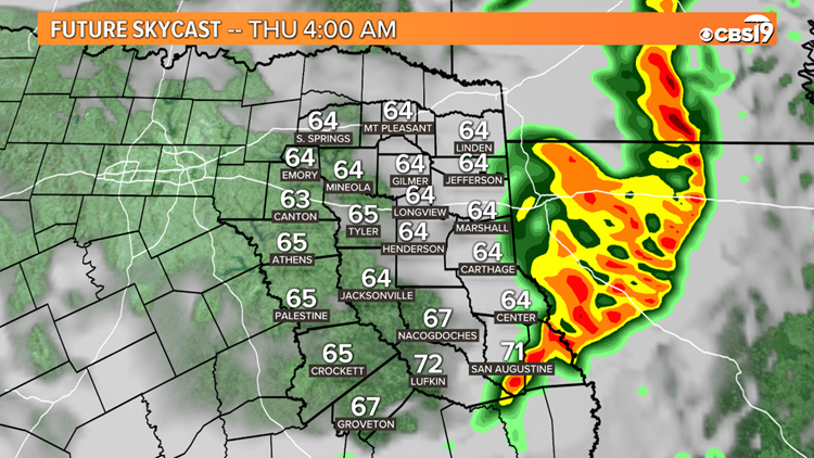
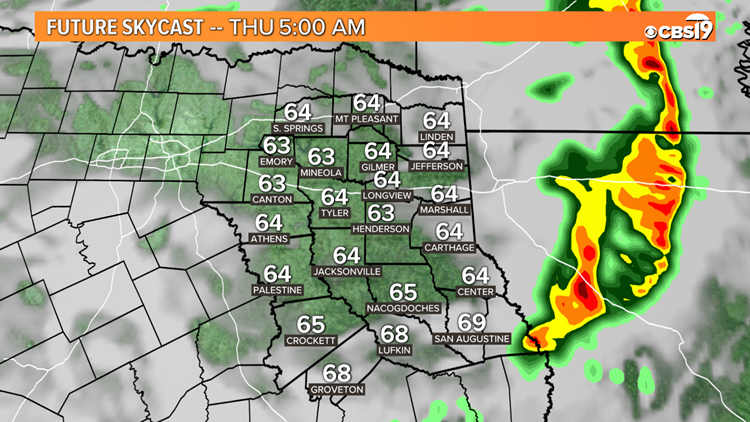
We have a Future Skycast timeline below, but please know that due to uncertainty with this forecast, storms could arrive several hours later than they do on the Future Skycast.
Future Skycast Timeline 5/1/2019 into 5/2/2019


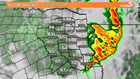

More Storms Late This Week:
In addition to the threat for severe storms Wednesday, almost all of East Texas will be under a marginal risk for severe storms on Thursday. This threat currently looks less impressive than Wednesday, but staying weather aware is still advised.
An additional marginal risk for severe weather will cover our southwestern counties on Friday, again currently looking less impressive than Wednesday, but you should still keep tabs on this situation for the latest updates.
Storm chances will be around 70% on Thursday and 60% on Friday.
These storms have the potential to be dangerous and should be treated seriously. CBS 19 will be watching the weather situation carefully and will have updates throughout the day on-air, online, and on social media. Make sure you have the app installed on your phone before tomorrow to get the latest alerts.
Connect with CBS 19 Chief Meteorologist Joel Barnes on social media:
Do you have a weather report or pictures you would like to submit to the CBS19 Weather team? You can email news@cbs19.tv and visit our Facebook or Twitter pages.
Severe Weather Preparation Tips: