
TYLER, Texas — Get ready for what could be the coldest Christmas in more than two decades here in East Texas.
It won't challenge any record cold temperatures, but Christmas air will definitely have a winter sting.
Will we have a White Christmas? At this time, it's not looking good. Christmas is more likely going to be cold and dry. But let's talk about the arctic air headed our way.
The North Pole is currently experiencing about 24 hours of darkness. The sun dips below the horizon in late September and doesn't rise again until mid-March.
The absence of sunlight can contribute to some brutally cold air developing over the Arctic circle and the North Pole. That is the case right now where a strong area of high pressure associated with some very cold has developed over Siberia.

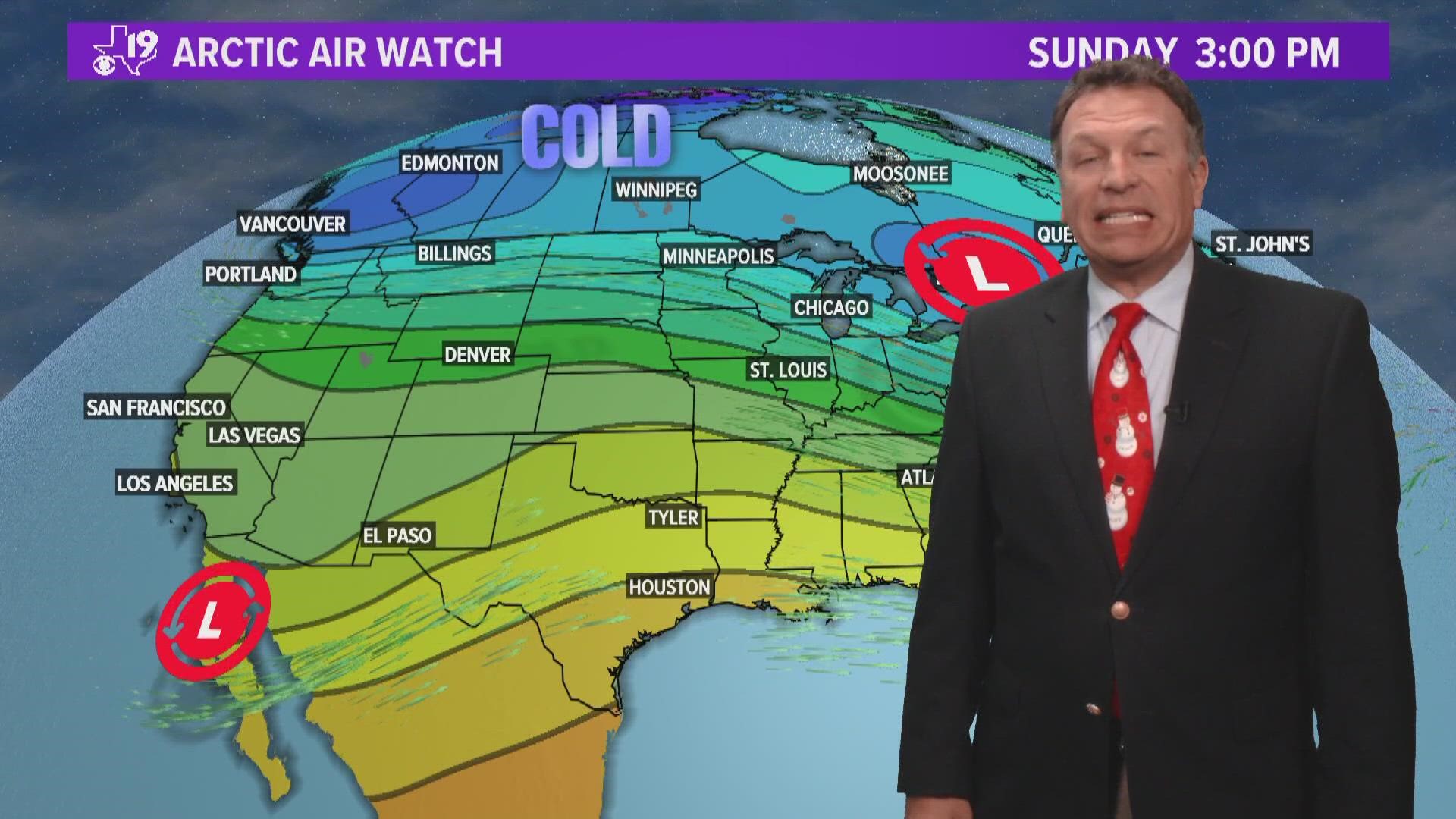
A chunk of this dangerously cold air will dislodge and move south across Canada and into the United States.
Computer guidance is in agreement the cold air will descend into the northern United States. Some guidance has suggested the coldest of this air will move through the Great Lakes and to the east coast bringing places such as Chicago, New York, and Washington D.C. the worst of the cold air.
But there is some computer modeling out there that suggests this large movement of air will follow the upper-level winds that oriented more north to south. That means Texas would be in line for a shot of some brutally cold air late next week and through Christmas weekend.

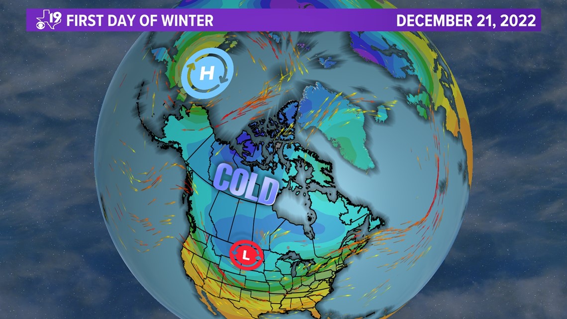
This year's cycling weather pattern suggest an area of high pressure off the west coast will push the cold air into the central and southern plains.
Past cycles have also included a large storm. Think back to what happened November 4th when we had a severe weather outbreak here in East Texas. We had temperatures well below average right after that storm passed to our east.
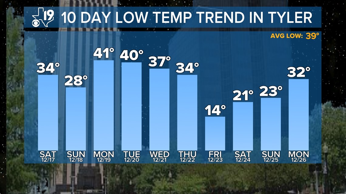
That part of the pattern is coming back next week, and we are seeing indications our temperatures could be 20 to 25 degrees below average.

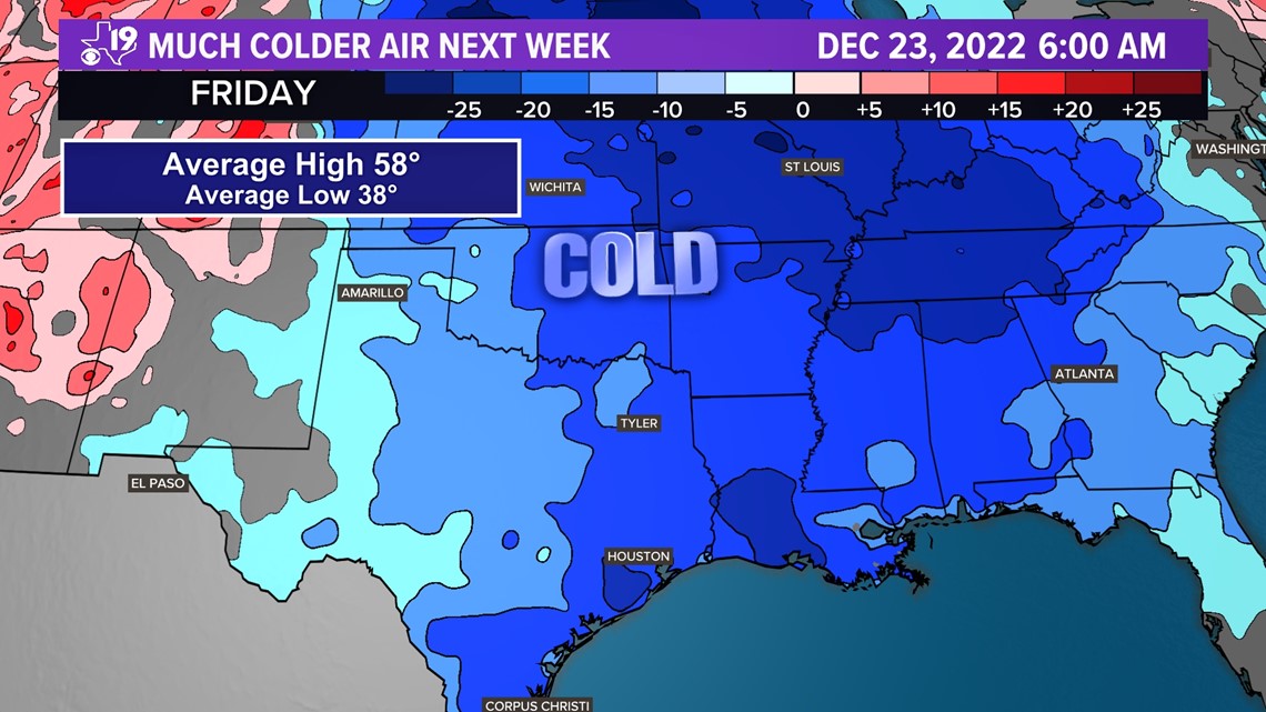
If the average high is 58 and the average low is 38, it means our highs Christmas weekend will be in the upper 30s and our morning lows will be in teens or low 20s.
That would easily make it the coldest Christmas weekend since 2000, if not 1998. In other words, if you have a fireplace, now might be a good time to stock up on some wood.

One more note, when cold air outbreaks like this move into the middle part of the United States, the jet stream becomes more energized and that can lead to waves in the jet stream that turn into storms.
With this amount of cold air around, that would mean snow or ice if any storm can form. We might still be unsure about a storm but our confidence is high it's about to get really cold.
So try and stay as warm as you can, either way winter arrives Wednesday at 3:48 PM here in East Texas.