TYLER, Texas — Here we go again. This is the third time this fall, the weather pattern is setting up with a chance of severe weather. We saw a tornado outbreak Nov. 4 and on Nov. 29, there was straight-line wind damage reported in Sabine County.
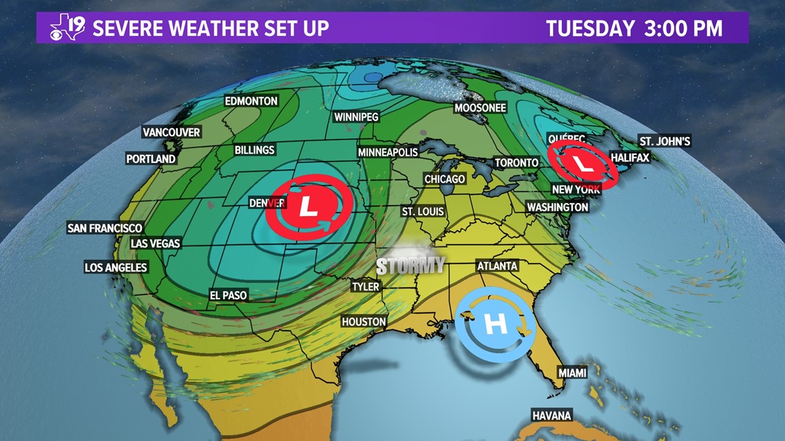
Now, Tuesday, Dec. 13, features a strong storm that could bring widespread severe weather to the central and southern plains. A deep low pressure area coupled with some very fast winds aloft will combine to make the atmosphere ripe for potential severe weather.

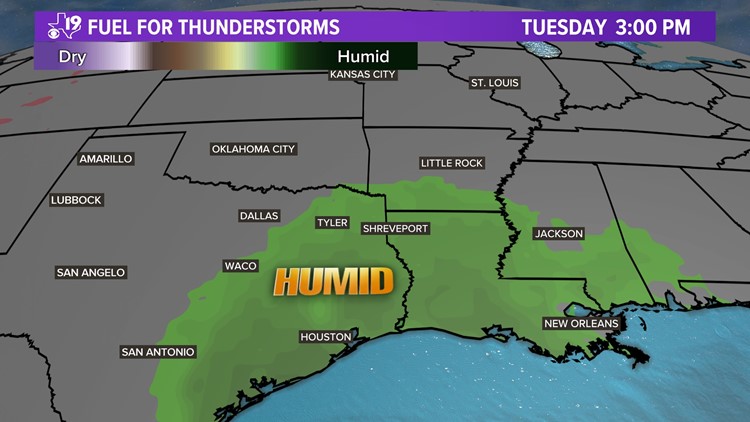
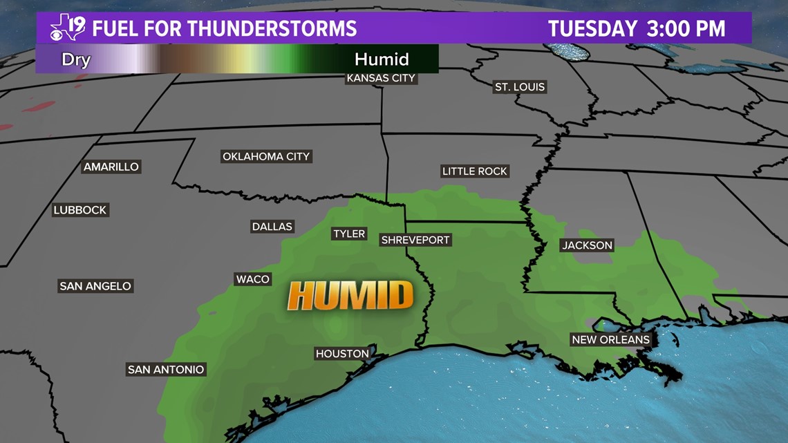
Thunderstorms need fuel and that fuel comes in the form of moisture. High pressure anchored over the Florida will feed lots of moisture into East Texas Monday and Tuesday. You'll feel it in the form of humidity and see it in the cloudy sky cover.

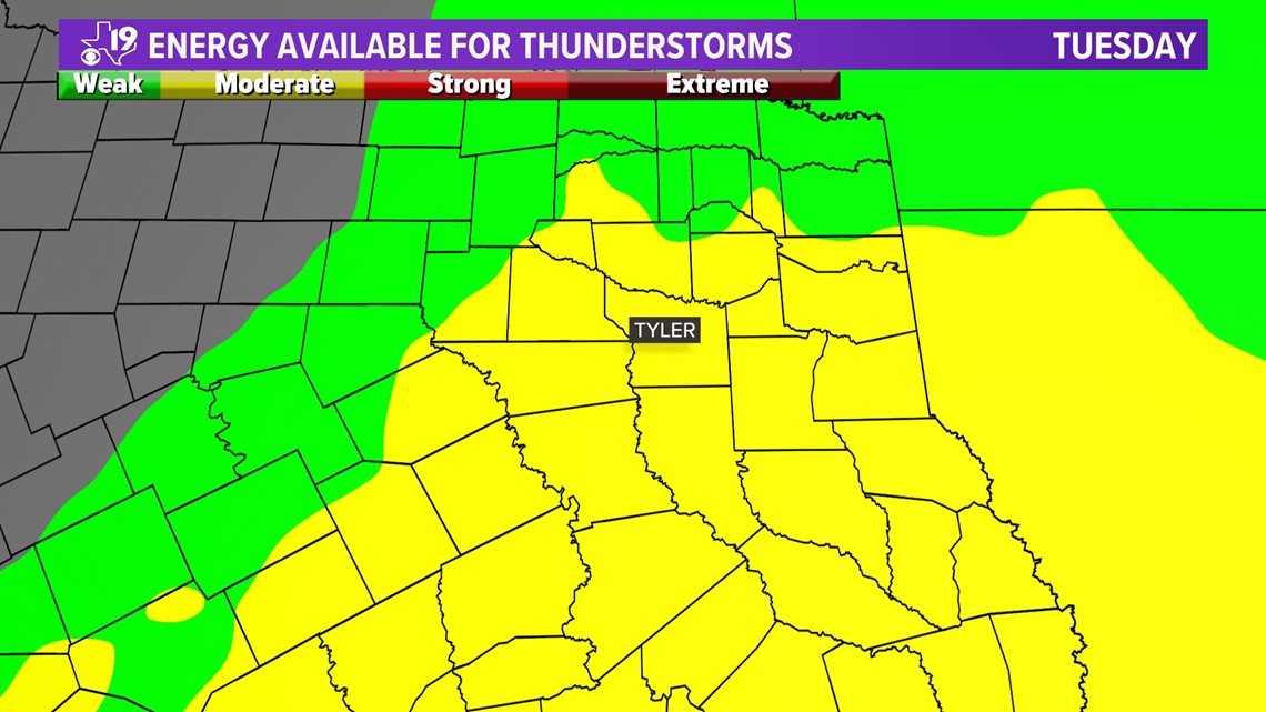
Another necessary ingredient is instability. Is the air cooling rapidly as it rises? Is there enough heat that will allow clouds to dramatically develop? Will the atmosphere have adequate potential energy that can lead to dangerous thunderstorms. This is measured in something called, CAPE or Convective Available Potential Energy. It can be used to estimate the updraft strength in a thunderstorm. We've seen more in East Texas but Tuesday there will be adequate CAPE for severe thunderstorms.

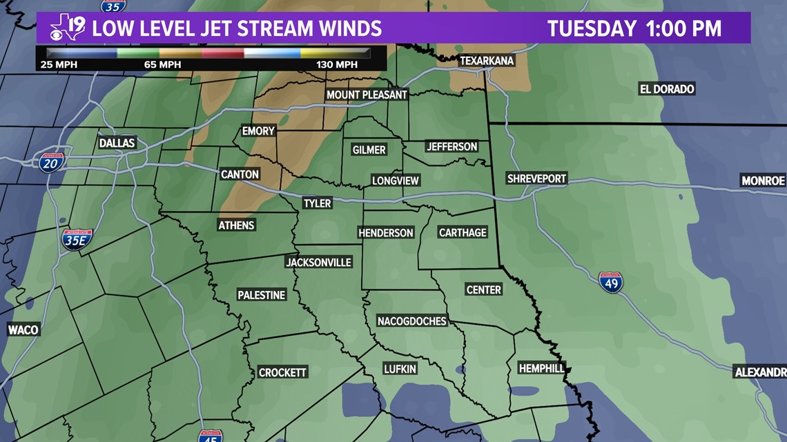
We will also be looking at a shear, the change of wind direction or speed with height. If the winds are turning as air rises through the atmosphere, it can begin to turn or twist. This can help tilt a thunderstorm updraft. This can lead to large hail and possibly a tornado. Sometimes strong winds pushing the thunderstorms can sink to the surface causing damaging wind gusts. On Tuesday afternoon, there will be winds in excess of 65 mph at around 5,000 feet. We can't rule out damaging wind gusts of that magnitude.

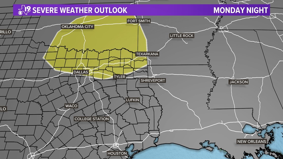
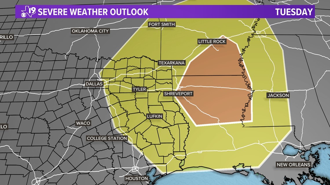
The Storm Prediction Center in Norman, Okla. is looking at all of these parameters and has already placed a portion of North Central and Northeast Texas in a slight risk of severe Monday night and the SPC has placed all of East Texas under a slight risk of severe weather for Tuesday and has included a large portion of Louisiana and southern Arkansas in an Enhanced Risk area.


We will be updating the CBS19 weather blog often between now and Tuesday. Please check back for updates and start reviewing your severe weather safety plan now. If you live in a mobile or manufactured home, start thinking about where you will go for shelter Tuesday. Make some calls and firm up where you can go if a tornado watch is issued. It's best to have a plan in place before severe weather hits.
Thanks for reading the CBS19 weather blog. Have a great weekend!