TAMPA, Fla. — Here's what we expect to see from the storm in the coming days.
Quick look at Hurricane Ian
- Hurricane Ian is a major hurricane peaking as a Category 4 storm with max sustained winds of 155 mph
- Ian has officially made landfall near Cayo Costa, FL as a strong Category 4 hurricane. This is the 2nd landfall. First landfall was in Cuba. This is the strongest hurricane to hit Florida since Category 5 Michael in 2018 in the Florida Panhandle.
- Ian is bringing life-threatening flooding (through storm surge and heavy rain) and high winds for parts of Florida.
- According to current projections, the storm will head north towards Orlando and Daytona Beach. It'll make a third landfall near the Georgia/South Carolina coast late this week and into the weekend. It will be much weaker but still maintaining Tropical Storm strength, but heavy rains and winds will still be possible for those areas.
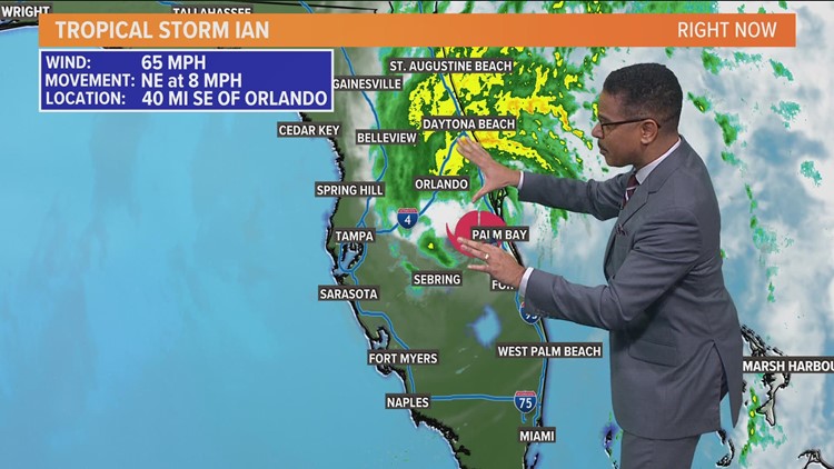
Latest Hurricane Ian radar:

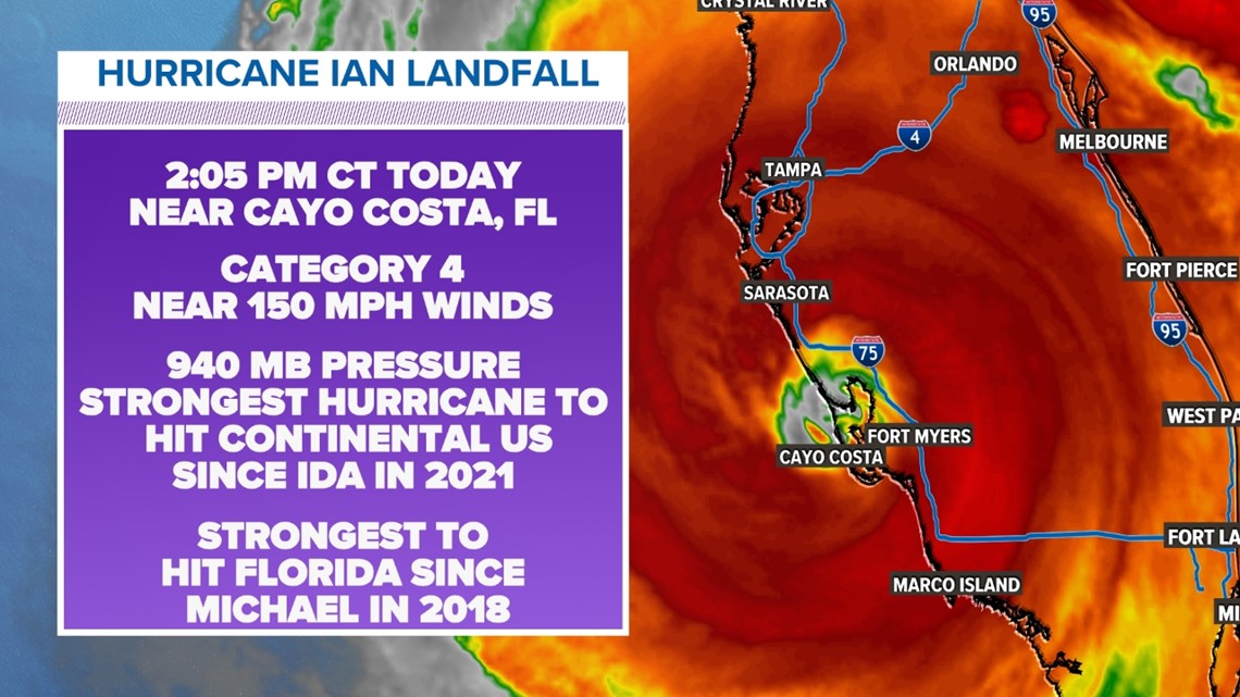
Ian has officially made landfall near Cayo Costa, FL as a strong Category 4 hurricane. This is the 2nd landfall. First landfall was in Cuba. This is the strongest hurricane to hit Florida since Category 5 Michael in 2018 in the Florida Panhandle.
A forecast of Hurricane Ian's path

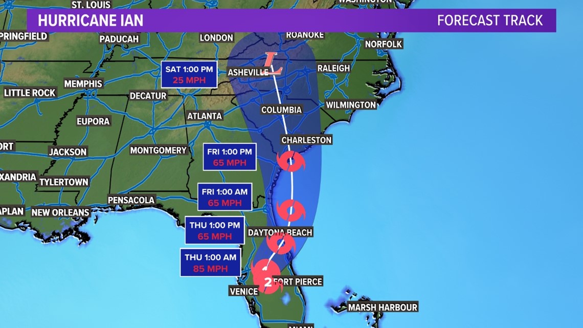
According to current projections, the storm will head north towards Orlando and Daytona Beach. It'll make a third landfall near the Georgia/South Carolina coast late this week and into the weekend. It will be much weaker but still maintaining Tropical Storm strength, but heavy rains and winds will still be possible for those areas.
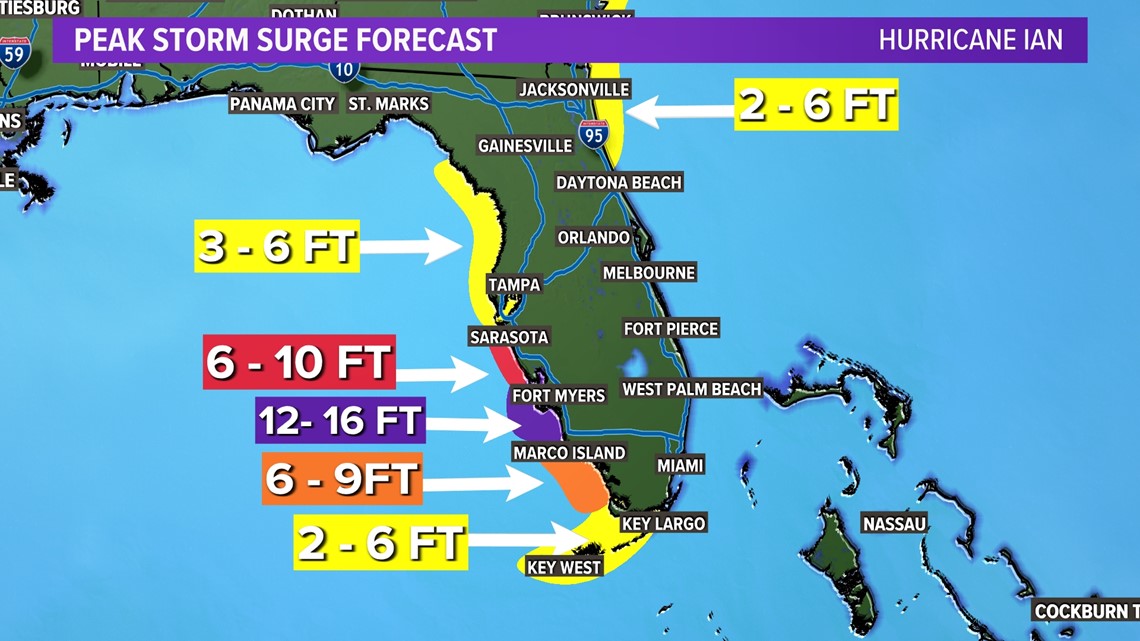
How much storm surge could Ian bring to Florida?
Because of Ian's slow speed along the coast, significant storm surge impacted for parts of the western coast of Florida -- especially from the Tampa Bay area to the south all along the coast.
With the center of the storm trending a little farther south, Tampa Bay storm surge amounts look problematic but not as high as originally thought.
Highest storm surge looks to be from around Sarasota to Fort Myers, which could be 8 to 16 feet in places.

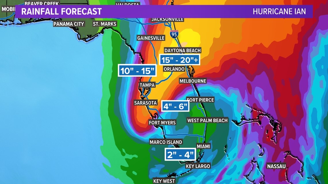
How much rainfall will Hurricane Ian bring?
Heavy rainfall will likely cause flooding in parts of Florida -- even in areas well away from the coast.
Most of the state can expect around four to six inches of rain fall as a result of Hurricane Ian.
Higher amounts -- anywhere from six 10 to 15 inches or more -- are possible for central Florida from Tampa to Orlando.

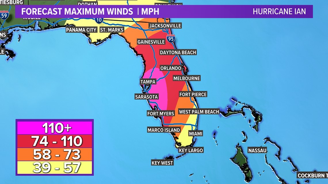
What kinds of wind speeds can we expect from Hurricane Ian?
The highest winds will come for areas along the coast or a little inland, which could see winds of above 110 miles per hour at points near Ian's landfall.
Other parts of Florida will also experience high winds, too. Areas stretching from Gainesville to Orlando to Marco Island can expect winds between 74 and 110 miles per hour.
Wind of this strength can cause tree damage as well as power outages for a significant part of the state.

Be sure to wake up with Greg Fields on Daybreak and watch Pete Delkus on WFAA News at 10 before bed to get the latest on Hurricane Ian as it approaches its Florida landfall in the coming days.