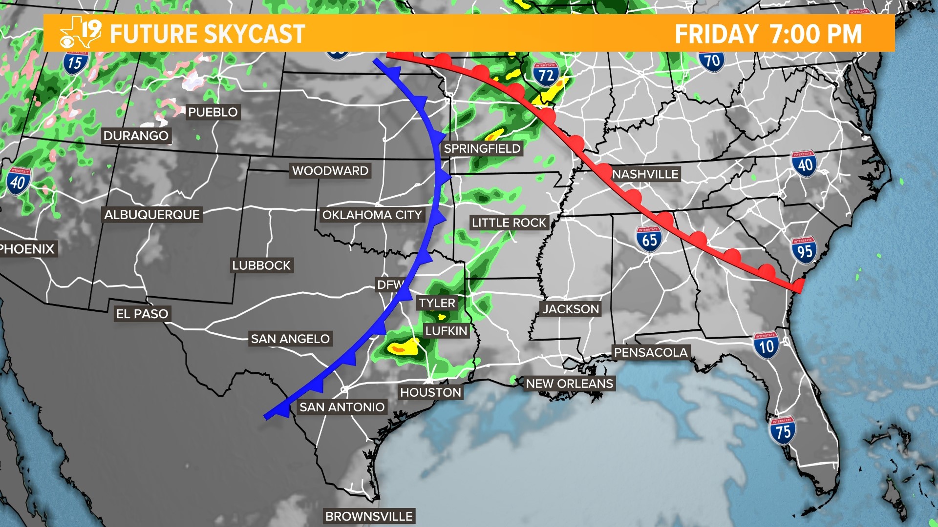
TYLER, Texas — Rain showers and thunderstorms will push through East Texas overnight and early Thursday morning. Gusty winds will be the most likely culprit, a brief tornado or up to quarter size hail cannot completely be ruled out; but these events are not very likely.
Timing:
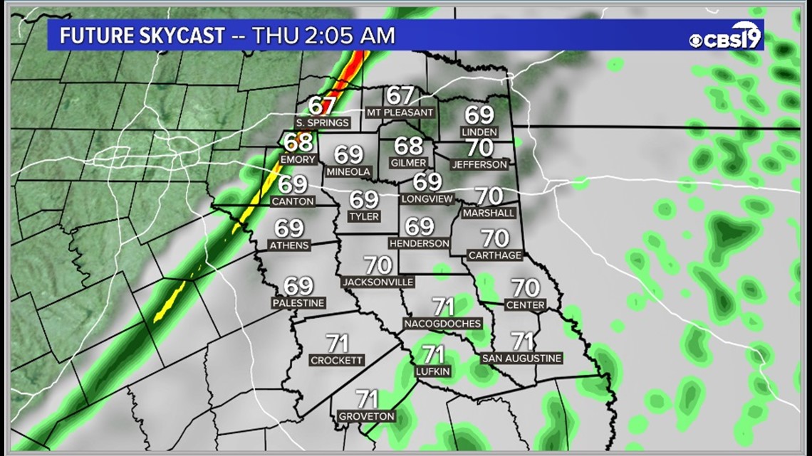
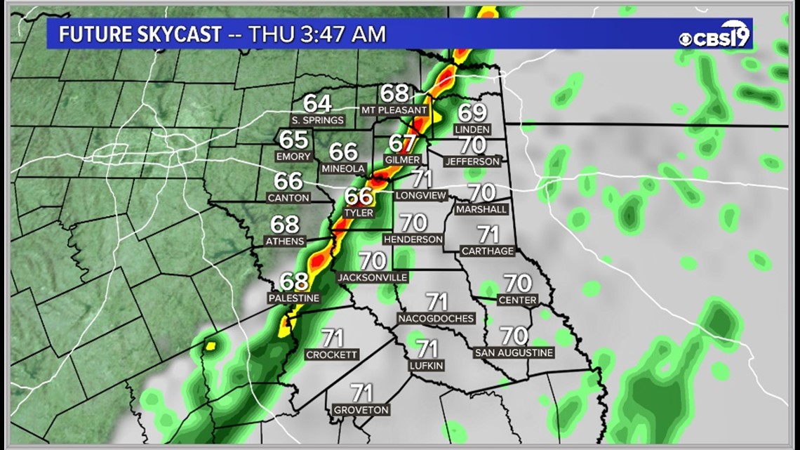
The timing of the front will bring one last chance for showers and storms between 2 AM and 7 AM across the region. The storms will fire up in Van Zandt, Rains & Hopkins counties by 2 AM, moving through Tyler by 4 AM, and Deep East Texas between 5 and 7 AM.
2 AM Location
4 AM Location
6 AM Location
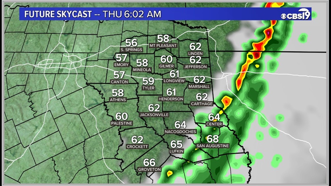
Make sure you are staying weather aware in these regions!
Impacts:
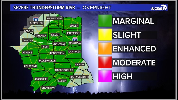
Almost all of East Texas is under a marginal risk (level 1 of 5) for severe weather tonight. Like this morning, the biggest concern is for strong damaging winds, but some hail or an isolated tornado cannot totally be ruled out.


In addition to the severe wind risk, winds will be gusty most of the night in general. Expect winds to be blowing from the southwest at 10 to 20 miles per hour, with some gusts as high as 25 MPH. Wind advisories are already in place for almost all of East Texas as a result.
With strong storms back in the forecast, make sure you are staying weather aware and following CBS 19 for the latest!
Connect with CBS 19 Chief Meteorologist Joel Barnes on social media:
Do you have a weather report or pictures you would like to submit to the CBS19 Weather team? You can email news@cbs19.tv and visit our Facebook or Twitter pages.