
TYLER, Texas — A large portion of East Texas experienced severe weather Monday evening into Tuesday morning.
As reports of damage come in, CBS19 will update out live blog throughout the day to make sure you're in the know before you hit the road.
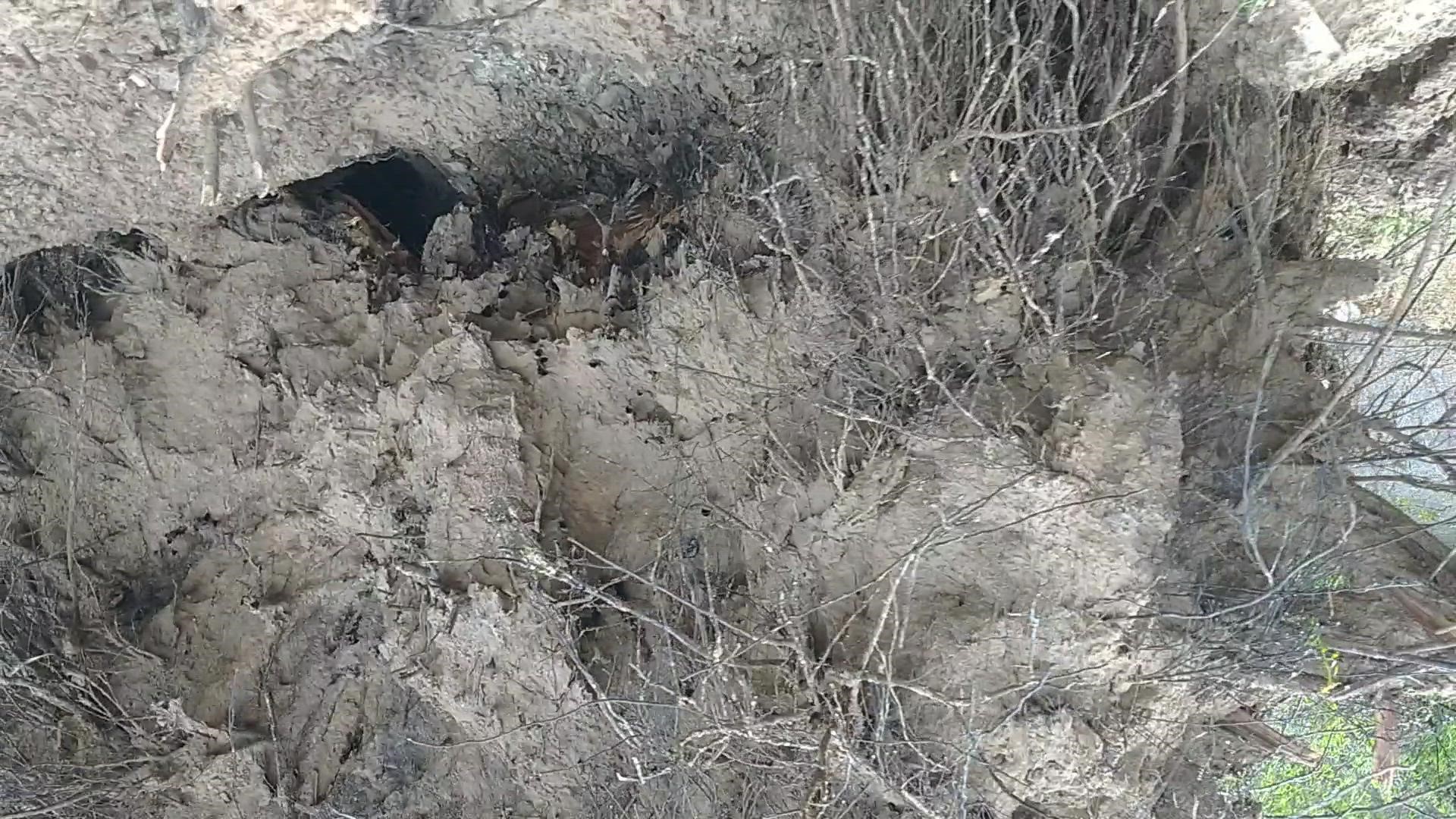
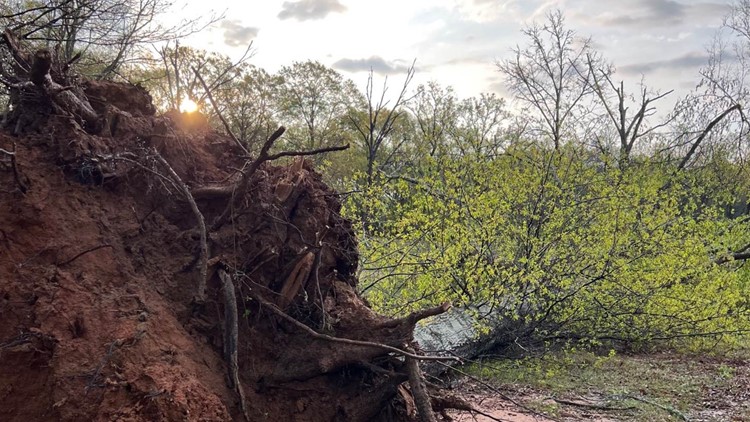
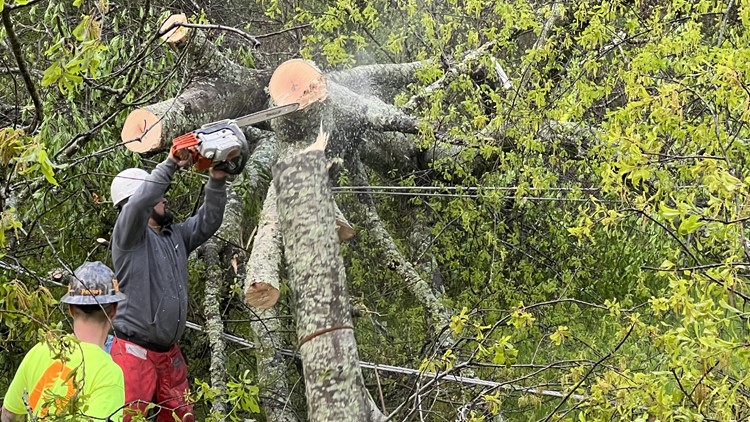
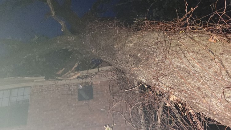
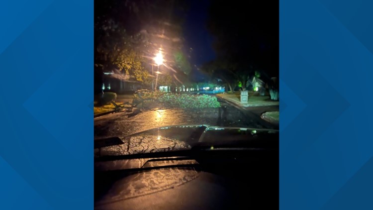
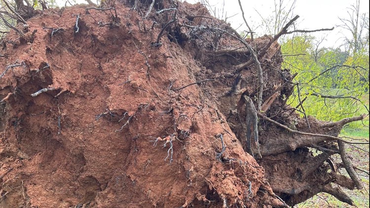
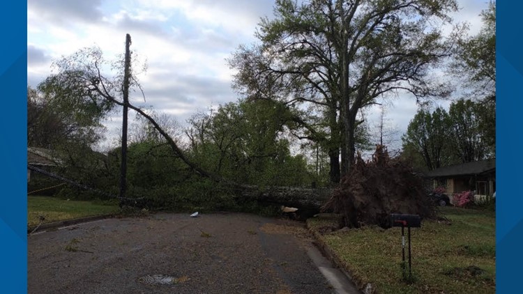
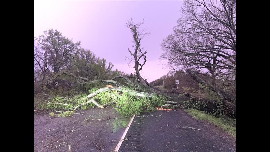
Photos: April 5, 2022 severe storms cause damage overnight in East Texas


TUESDAY, APRIL 5
3:53PM: The Smith County Road and Bridge crews have cleared all reported downed trees from County Roads as of 3:30PM. The crews were called out at 3 AM to respond to clear the roads throughout Smith County due to the storms earlier this morning. All trees have been cut-up and moved to the side of the road and will be picked up throughout the week.
11 AM: The National Weather Service in Shreveport has a team coming to the Whitehouse area to survey damages related to the severe weather overnight Tuesday.
9:30 AM: Smith County officials began helping the cities of Whitehouse and Troup in the early morning hours of Tuesday as severe storms struck the area.
“I want to thank all of the Road and Bridge Department, law enforcement, first responders and emergency management personnel in the City of Whitehouse for their quick and diligent work in responding to this severe weather event overnight,” Smith County Judge Nathaniel Moran said. “I am devastated that a life was lost during this event, and my prayers will be with the family of the lost and those displaced as we continue to work through this situation.”
According to the county, Smith County Engineer Frank Davis said Road and Bridge crews were called out around 3 a.m. and they are continuing to clear county roads. Davis said that some of the trees are connected to power lines, and those removals will take longer because of the need to wait for electrical companies.
To report downed trees in Smith County, people can call the non-emergency dispatch at 903-566-6600 or Road and Bridge at 903-590-4801. Drivers are encouraged to use caution, especially on rural county roads.
At least 21 roads in Smith County have trees down as of 9 a.m. The list includes: CR 2166, CR 2221, CR 246, CR 290, CR 294, CR 2191, CR 2298, CR 2188, CR 490, CR 2138, CR 26, CR 251, CR 1155, CR 192, CR 223, CR 2290, CR 2294, CR 1274, CR 1100, CR 1125, and 1274.
7:44AM: According to the Tyler Police Dept., the intersection signal lights at Paluxy Dr. and Grande Blvd. are out due to the storms. Tyler police are in the roadway directing traffic. Please avoid this area if possible.
Some other intersections throughout the city are being controlled with portable stop signs. Please watch for debris in the roadway, especially in outlying areas. Drive carefully.
6AM: The Smith County Fire Marshal's Office has confirmed one death in connection with overnight storms.
3AM: The Severe Thunderstorm Warning has expired for all the effected counties in East Texas.
2:45AM: Power lines reported to be down in Whitehouse. According to Tom Trimble, don't go near any power lines, instead call 9-1-1 and let the police know where it is.
2:38AM: The National Weather Service has issued a Severe Thunderstorm Warning for Harrison and Panola Counties until 3:30 AM.
2:36AM: Minor damages in Rusk County. Large tree reported to be down across US 259 between Kilgore and Henderson. Trees and debris across FM 225, South of Henderson.
2:26AM: Video coverage of the severe weather coverage coming to the KYTX CBS19 station as the storm came into Tyler:

Photos: April 5, 2022 severe storms cause damage overnight in East Texas
2:21 AM: 65 MPH winds reported in Tatum, Monroe and Stewart. Our team recommends that you get to a safe space as soon as possible.
2:19AM: The National Weather Service in Shreveport radar is back up and has been restored, allowing our coverage to stay up-to-date.
2:16AM: The National Weather Service in Shreveport radar is down due to the storm.
2:10AM: Crews are working to remove downed trees and debris from roadways in Van Zandt County, as reported by Marangeli Lopez:


2:03AM: Damage in Van Zandt County on SH19:

1:58 AM: Wind gusts reported up to 80 MPH in Henderson, Kilgore and Carthage until 3:00 AM
1:57AM: Trees reported on houses in Whitehouse, between 110 and Main St.
1:54AM: Our weather team is currently covering the severe weather as it comes into East Texas. Our station has had power outages occur, but the stream and further updates can be found live here:
1:33AM: For those that live in Whitehouse, do not wait for a Tornado Watch to be sent out. There are power flickers and changing in pressures, which could lead to a dust-up of a tornado. Get to a safe space sooner rather than later.
1:30AM: 72 MPH winds reported in Brownsboro. The winds could reach upwards of 79 MPH and are heading toward Whitehouse and Tyler. Those who are in that path, CBS19's Chief Meteorologist Brett Anthony recommends those enter their safe place against the high-speed winds.
1:24AM: The National Weather Service has reported that six miles northeast of Mabank, a homeowner has reported a roof was blown off and damage reported in Van Zandt County.
1:16AM: According to CBS19's Marangeli Lopez, there is heavy rain that has passed through Van Zandt County. Lightning can be seen throughout the skyline.
1:08AM: The National Weather Service has extended the Severe Thunderstorm Warning for Cass County until 2:00 AM.
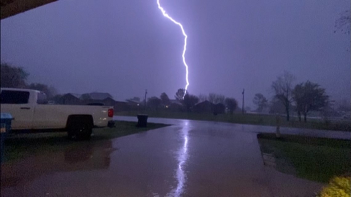
1:06AM: Lightning strike image from Gun Barrel City, curtsey of Jordan Timms:

1:03AM: The National Weather Service has issued a Severe Thunderstorm Warning until 2:00 AM for the following counties:
- Cherokee
- Rusk
- Smith
- Gregg
1AM: The National Weather Service has issued a Severe Thunderstorm Warning until 1:45AM for the following counties:
- Harrison
- Wood
- Upshur
- Cass
- Gregg
- Marion
- Morris
- Camp
- Titus
12:58AM: The National Weather Service has issued a Severe Thunderstorm Warning until 1:30 AM for Van Zandt County.
12:52AM: The National Weather Service has issued a Severe Thunderstorm Warning until 1:30 AM for Henderson County.
12:51AM: Murchison, Van, Brownsboro and Tyler Pounds can have winds up to 65 MPH. Heavy rain, frequent rain and heavy wind.
12:48AM: According to CBS19's Chief Meteorologist Brett Anthony, severe thunderstorms are starting to move into Smith County, and should come by 1:00 AM. Heavy rain could cause flooding from Canton and into Corsicana. Winds are projected to be 35 MPH.
12:23AM: The National Weather Service has issued a Severe Thunderstorm Warning until 1:15 AM for Cass, Morris, and Titus Counties
12:16AM: The National Weather Service has issued a Severe Thunderstorm Warning until 1:15 AM for Van Zandt County
12:07AM: The National Weather Service has issued a Severe Thunderstorm Warning until 1:00 AM for Henderson County.
12:05PM: Rusk County Office of Emergency Management are reminding those who are in need of shelter that there are two locations to go to:
MONDAY, APRIL 4
11:48PM: The City of Van is reporting that they have experienced wind damage in Midlothian, including an 18-wheeler being flipped over.
11:42PM: The National Weather Service has issued a Severe Thunderstorm Warning until 12:30AM for Franklin, Morris, and Titus Counties.
11:07PM: The National Weather Service has issued a Severe Thunderstorm Warning for Franklin and Titus Counties until 11:45PM.
10:52PM: The National Weather Service has issued a Tornado Watch until 4:00AM for the following counties:
- Cherokee County
- Wood County
- Rusk County
- Cass County
- Smith County
- Marion County
- Morris County
- Titus County
- Franklin County
- Harrison County
- Upshur County
- Gregg County
- Nacogdoches County
- Shelby County
- Camp County
- Panola County
10:06PM: The National Weather Service has issued a Severe Thunderstorm Warning for Hopkins County until 11:00PM
7:25PM: The National Weather Service has issued a Tornado Watch for Henderson; Van Zandt; Rains; and Hopkins Counties until 2:00 AM.
7:15PM: From CBS19's Chief Meteorologist Brett Anthony, the storm is not supposed to come into East Texas until 11 PM, with upwards of 75 MPH winds. There is currently a Tornado Warning in Montague County, close to the Red River. The risk of hail has been reduced, but is still possible.
2PM: The Rusk County Office of Emergency Management (OEM) says Landmark Missionary Baptist Church (202 NW 1st St. in Mount Enterprise) and First Baptist Church (207 W. Main St. in Henderson) have both agreed to open as storm shelters Monday night for Rusk County residents without safe shelter during the storm. The churches plan to open at 10 p.m. and close after the storm clears the area.
During the recent tornado, Rusk County saw many homes significantly damaged. If you reside in a mobile home, RV trailer, or older home that may not be safe, the OEM recommends staying with family, friends or at one of the shelters.
"Feel free to bring snacks or drinks, but we ask you to respect the churches and other community members by leaving the buildings as clean as they were when you arrived," the OEM said.
8:58AM: A Flood Warning issued until April 7, at 3 p.m. for Franklin, Morris and Titus counties.
8:23AM: A Flood Warning issued until April 9, at 7 p.m., for Angelina and Nacogdoches counties.
Stick with CBS19 for the latest on the severe weather threat in your area.