
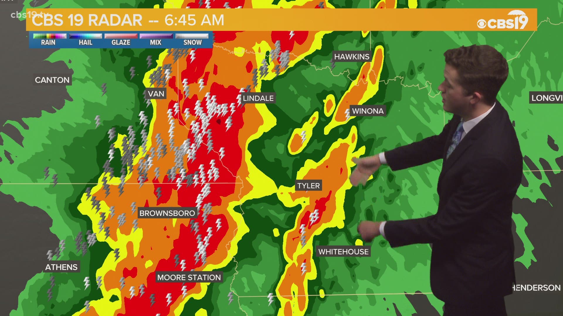
TYLER, Texas — While the weather was relatively quiet overnight, severe storms are possible to kick off St. Patrick's Day.
Between 5 a.m. - 8 a.m., East Texas' severe weather chances increase to a 2 out of 5 (slight) risk, meaning the threat is a little greater.
The following counties are currently under a Severe Thunder Storm Warning:
- Cass County (until 9:30 a.m.)
- Gregg County (until 9:30 a.m.)
- Harrison County (until 9:30 a.m.)
- Marion County (until 9:30 a.m.)
- Nacogdoches County (until 9:45 a.m.)
- Panola County (until 9:45 a.m.)
- Rusk County (until 9:45 a.m.)
- Shelby County (until 9:45 a.m.)
A Severe Thunderstorm Watch is in effect for the following counties:
- Anderson County (until 10 a.m.)
- Henderson County (until 10 a.m.)
- Hopkins County (until 10 a.m.)
- Rains County (until 10 a.m.)
- Van Zandt County (until 10 a.m.)
A Tornado Watch has been issued for the counties below:
- Angelina County (until 1 p.m.)
- Nacogdoches County (until 1 p.m.)
- Sabine County (until 1 p.m.)
- San Augustine County (until 1 p.m.)
- Shelby County (until 1 p.m.)
For Wednesday morning, hail, thunder and lightning, straight-line winds, and a brief tornado or spin-up are all possible under this threat.

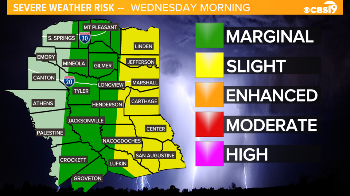
How are risks measured?
- Marginal Risk (Green) - An area of severe storms of either limited organization and longevity, or very low coverage and marginal intensity.
- Slight Risk (Yellow) - An area of organized severe storms, which is not widespread in coverage with varying levels of intensity.
- Enhanced Risk (Orange) - An area of greater (relative to slight risk) severe storm coverage with varying levels of intensity.
- Moderate Risk (Red) - An area where widespread severe weather with several tornadoes and/or numerous severe thunderstorms is likely, some of which should be intense. This risk is usually reserved for days with several supercells producing intense tornadoes and/or very large hail, or an intense squall line with widespread damaging winds.
- High Risk (Magenta) - An area where a severe weather outbreak is expected from either numerous intense and long-tracked tornadoes or a long-lived derecho-producing thunderstorm complex that produces hurricane-force wind gusts and widespread damage. This risk is reserved for when high confidence exists in widespread coverage of severe weather with embedded instances of extreme severe (i.e., violent tornadoes or very damaging convective wind events).
The good news is the stormy activity will clear out Wednesday afternoon leaving sunny skies and a beautiful end to the week.
Make sure you're keeping up with the latest news, weather and sports by downloading the free CBS19 mobile app.
CBS19 App
Click here to download the iPhone app.
Click here to download the iPad app.
Click here to download the Android app.
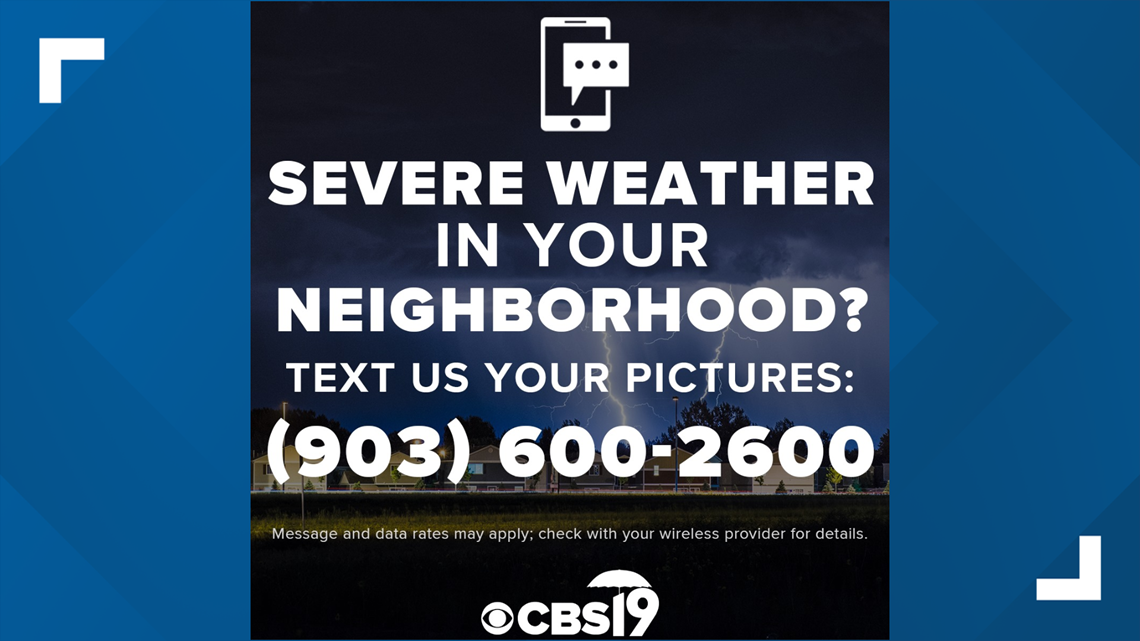
If you have weather photos you'd like to submit to the CBS19 Weather Team, text them to (903) 600-2600.

Stick with CBS19 everywhere you go. And don't worry, we've got you covered!