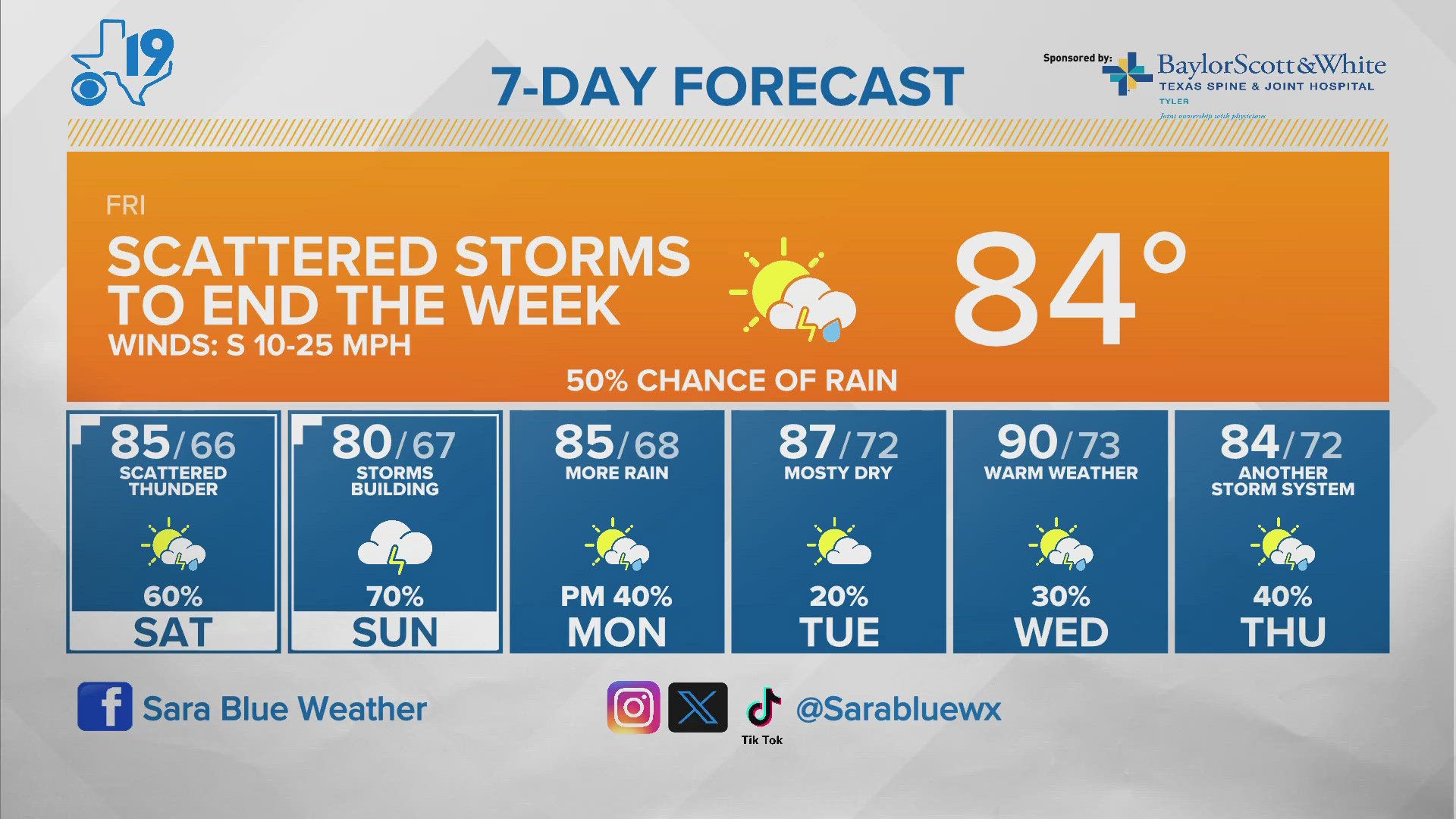
TYLER, Texas — So far this spring, severe weather continues to largely miss East Texas. Except for Super Bowl Sunday when large caused damage across south Tyler and April 9 when heavy rain and wind knocked down trees and washed out roads in scattered areas across East Texas.
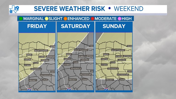
The spring severe weather outlook issued in early March cautioned of increased severe weather setups by the end of April, lasting into early May. And right on schedule, severe weather season is starting to finally show up in East Texas. The Storm Prediction Center is forecasting the possibility of severe weather across East Texas Friday and Sunday.


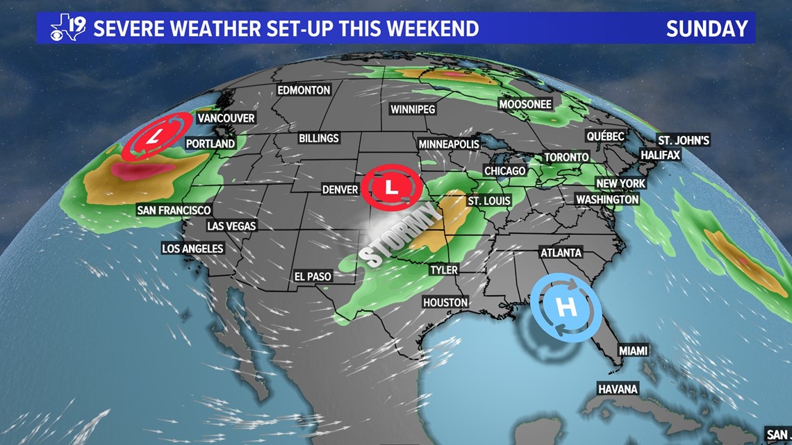
It make sense for two reasons. 1) The weather pattern is cycling and using the Long Range Cycling weather pattern theory the team was able to pick out this part of the weather pattern where storms would return and bring a severe weather threat. We've seen a storm similar to this in the middle of March. That storm produced more than 800 severe weather reports across the central U.S.


2) A strong El Nino weather pattern is beginning to weaken. El Nino is the warming of the equatorial waters in the Pacific Ocean. The warmer water allows thunderstorms to build over the Pacific Ocean. These thunderstorms change the way the wind flows over the United States and can result in a less active season weather season for the Central and Southern Plains. Now that El Nino is breaking down, we may see more active weather until severe weather season in mid to late May. The forecast pattern for the upcoming weekend mirrors that change.

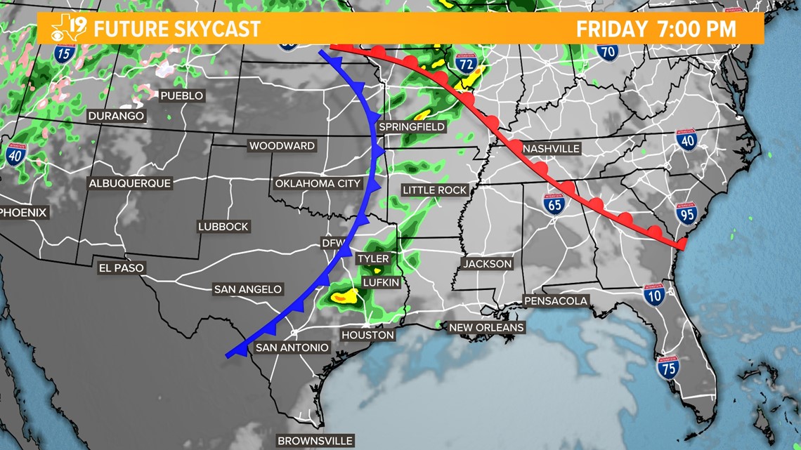
The weekend severe weather setup is not a slam dunk sign that East Texas will see severe weather. We might just see more heavy rain and thunderstorms. That means no damaging winds or tornadoes. We will have plenty of instability and for a few hours Friday evening and Sunday morning there will be sufficient low-level flow to sustain updrafts in thunderstorms that would give thunderstorms a better chance of turning severe. However, the best upper level winds will be farther north in Arkansas, Oklahoma, Kansas and Missouri.

If you're worn out by rain, there is some good news. Once we get to the start of May, the medium computer models hint at an early summer-like weather pattern setting up that would result in several dry days and warmer temperatures -- maybe even our first 90-degree day of 2024. In the meantime, people should review their severe weather plan and make sure they have more than one way to receive watch and warning information.