
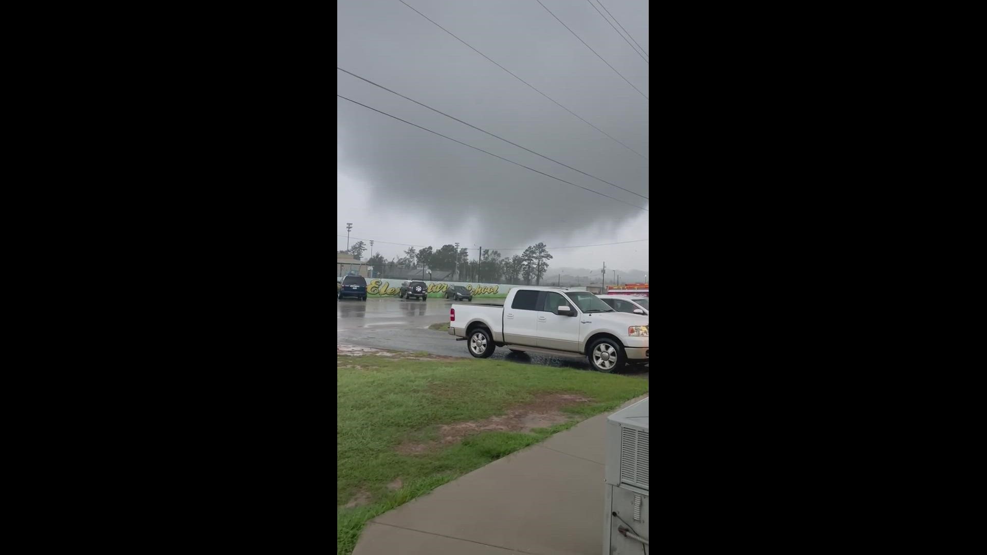
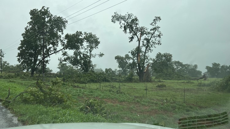
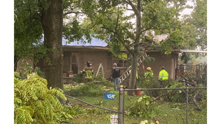
TYLER, Texas — The National Weather Service and local officials confirmed a tornado damaged several homes and the football field and downed some powerlines in Winona Monday morning amid significant storms.
Smith County Fire Marshal Jay Brooks said around 10:36 a.m., a deputy spotted the twister land on the Winona High School football field. He said it caused damage on Hussey Cir. and Johnson Rd. in Winona.
The National Weather Service out of Shreveport later confirmed a tornado touched down in Winona Monday morning.
The video above, taken by Garland Harroff, explained that it was his first tornado ever and it "sounded like a freight train." He saw the tornado's path go through the football field.
"I was very impressed with the school's response time," added Harroff.
According to Fire Marshal Brooks, the Winona ISD police chief said the school was briefly placed on lockdown, but returned to its regular schedule around 11 a.m.
Winona ISD Superintendent Damenion Miller said the students and staff sheltered into place quickly as the tornado came near the school district.
"And from there, we began to hear the the weather alerts come out at that time, and from what I could tell a tornado touchdown very close to the high school campus [but] did not do much damage to our high school buildings, but we had some outlier facilities that we're damaged," Miller said.
Miller said the outlier facilities that were damaged were a storage building built by students, the baseball field home side dugout roof, a greenhouse and another storage building.
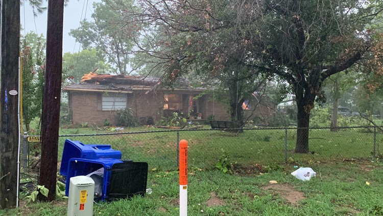
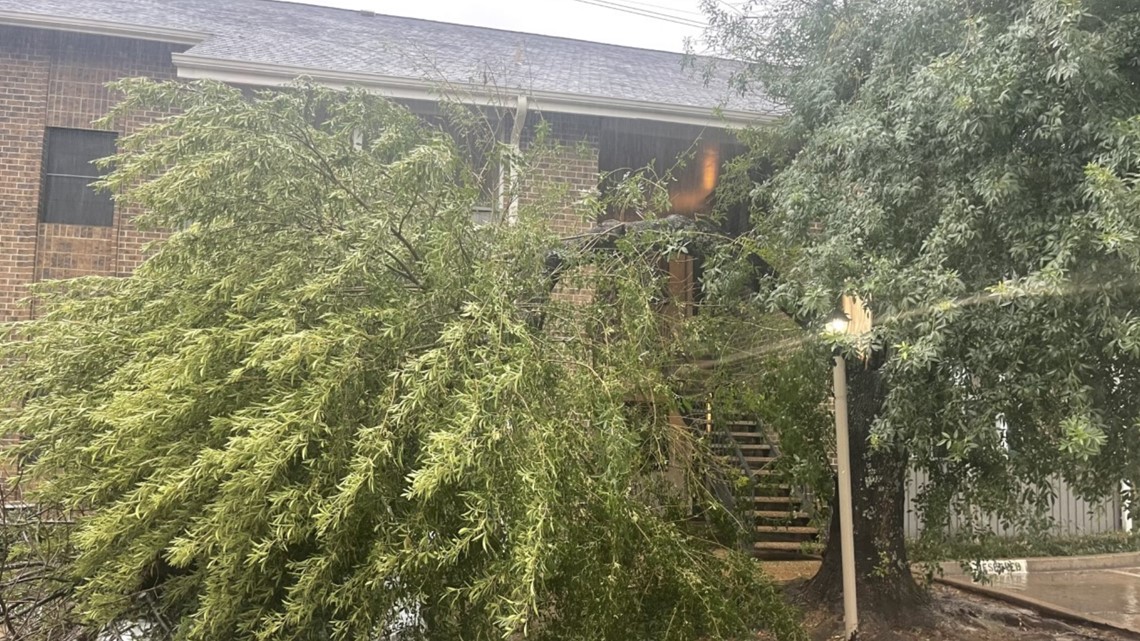
In a statement, Brooks said four houses have been damaged and there has been damage to power lines and to the high school. The National Weather Service said the tornado then moved out of Smith County.
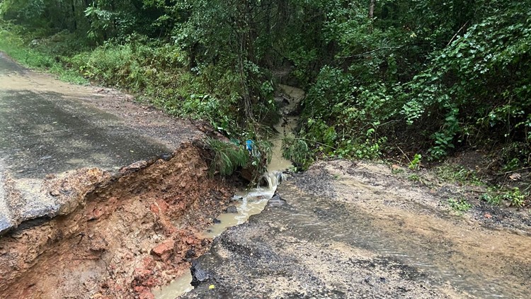
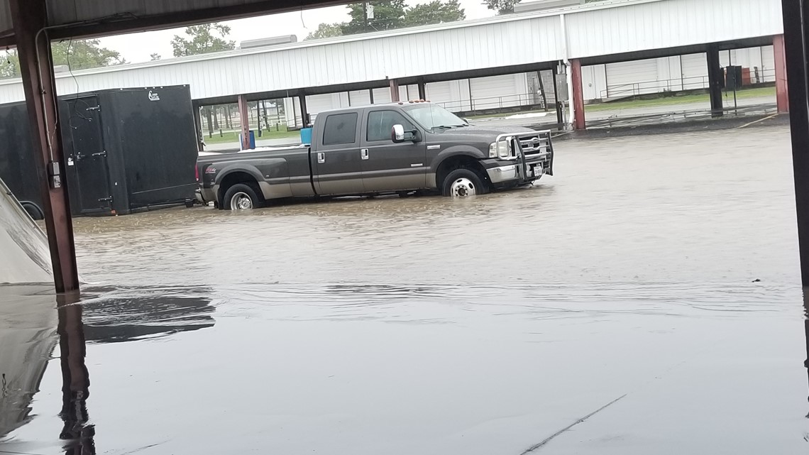
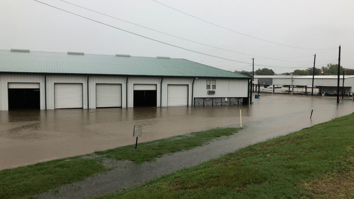
Storm damage in Winona and Gilmer


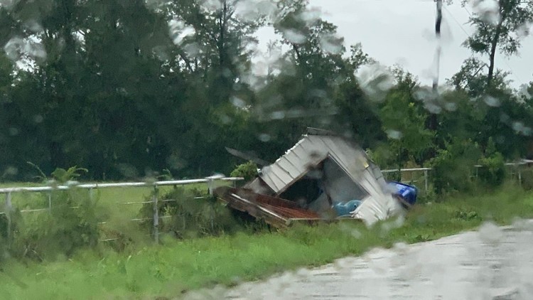


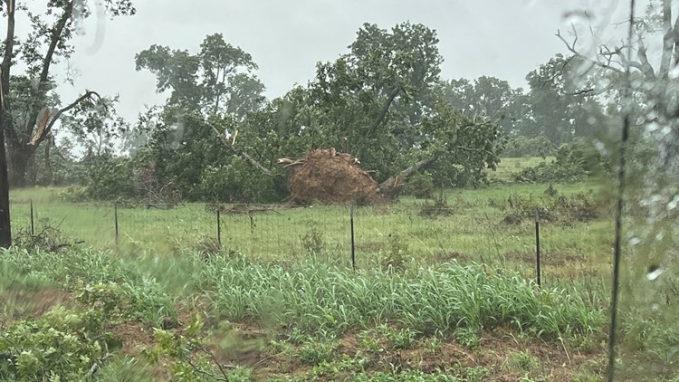


Smith County Pct. 4 Constable Josh Joplin said the reported cyclone took down a fence perimeter of the city water tower, destroyed a modular building, and threw football equipment from the football field into a nearby pasture. He also spotted a portable building lying in the middle of Johnson Road.
Joplin said the storm appeared to have spun up on Johnson Road, traveled across the Winona High School field, over to Hussey Circle and moved north toward Big Sandy. He also noted quite a bit of damage in the Hussey Circle neighborhood.
“This probably is the only one I’ve seen that’s done this amount of damage in a short amount of time,” Joplin said.
Powerlines are also down in the area, Brooks said.
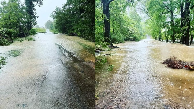
The First Monday Trade Days grounds in Canton also saw flooding as well during Monday's storms.
When severe weather strikes, CBS19 will be here to give you minute-by-minute updates.
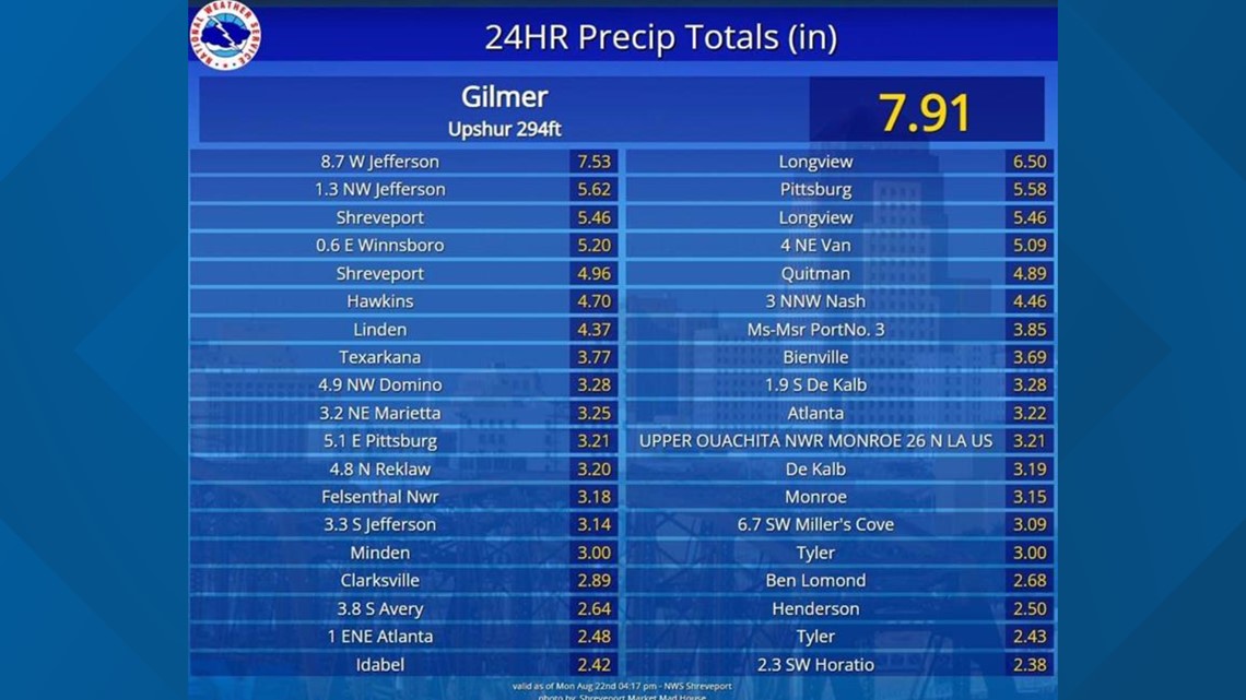
The NWS created a graphic showing the amount of rainfall the east Texas region accrued over the last 24 hours. Gilmer reported 7.91" of rainfall!

Rain and storms look to become more scattered going into Monday afternoon. Temperatures will be cool for August in the lower 80s.
Please remember that flooding can be dangerous and it only takes 6" of rain to sweep you off your feet.


A Flash Flood Warning is in effect for the following counties until 2:15 p.m.:
- Western Camp County
- Southwestern Franklin County
- West Central Gregg County
- Smith County
- Western Upshur County
- Wood County
A Flash Flood Watch has been issued for the following areas:
- Van Zandt County (until Aug. 22, at 8 p.m.)
- Rains County (until Aug. 22, at 8 p.m.)
- Hopkins County (until Aug. 22, at 8 p.m.)
- Wood County (until Aug. 22, at 7 p.m.)
- Rusk County (until Aug. 22, at 7 p.m.)
- Cass County (until Aug. 22, at 7 p.m.)
- Smith County (until Aug. 22, at 7 p.m.)
- Marion County (until Aug. 22, at 7 p.m.)
- Morris County (until Aug. 22, at 7 p.m.)
- Titus County (until Aug. 22, at 7 p.m.)
- Franklin County (until Aug. 22, at 7 p.m.)
- Harrison County (until Aug. 22, at 7 p.m.)
- Upshur County (until Aug. 22, at 7 p.m.)
- Gregg County (until Aug. 22, at 7 p.m.)
- Camp County (until Aug. 22, at 7 p.m.)
- Panola County (until Aug. 22, at 7 p.m.)
- Houston County (until Aug. 23, at 7 p.m.)
- Trinity County (until Aug. 23, at 7 p.m.)
The NWS reports flooding has taken over County Road 1513 and County Road 1560, near Alba, in Wood County.
In the city of Van, the following streets are closed due to flooding: Palm between Stadium and Pennsylvania, W. Ohio between N. Birch and County Road 1502, and Walnut between Ohio and Main.
The fire department asked people not drive around the street barricades.
Due to intense flooding, Rains ISD has canceled classes for Monday. Meet the Wildcats, originally scheduled for Monday evening, has also been called off.
Quitman ISD says due to the threat of severe weather and flooding, the district will be releasing students at 1 p.m. For safety, students will not be released from the bus if a parent or guardian is not home. If a parent or guardian is not home the students will be returned to the elementary school campus and may be picked up in the front office.
The NWS reported a flash flood around 6:20 a.m. in Upshur County saying an area of Holly Rd. in the Gilmer area has washed out and a few trees are down.
Trees have been reported down in the 1200 block of Graham Dr. in Tyler.


Eastern Camp County is also experiencing severe flooding.

