TYLER, Texas — Although the phrase "Saharan Dust" sounds worrisome, it is a phrase that should hold no concern; this event happens about every year.
Saharan Dust occurs in late summer or early fall, but this year it is occurring ahead of schedule, meaning it is called the "Saharan Dust Layer." We've had several rounds of the dust already this summer, but the thickest plume may arrive next week.
What is Saharan Dust? It's a dust cloud that forms every year due to storms in the African Sahel region, which borders the Sahara desert. The trade winds then send plumes of that dust across the Atlantic and into the Gulf of Mexico.
The satellites in our weather center pick up the activity of when the dust layer is thick. It has been thick enough several times since the middle of May for us to track. The proper name for tracking this thickness is "Aerosol Optical Thickness", with a graphic below showing what the dust layer looks like from space.

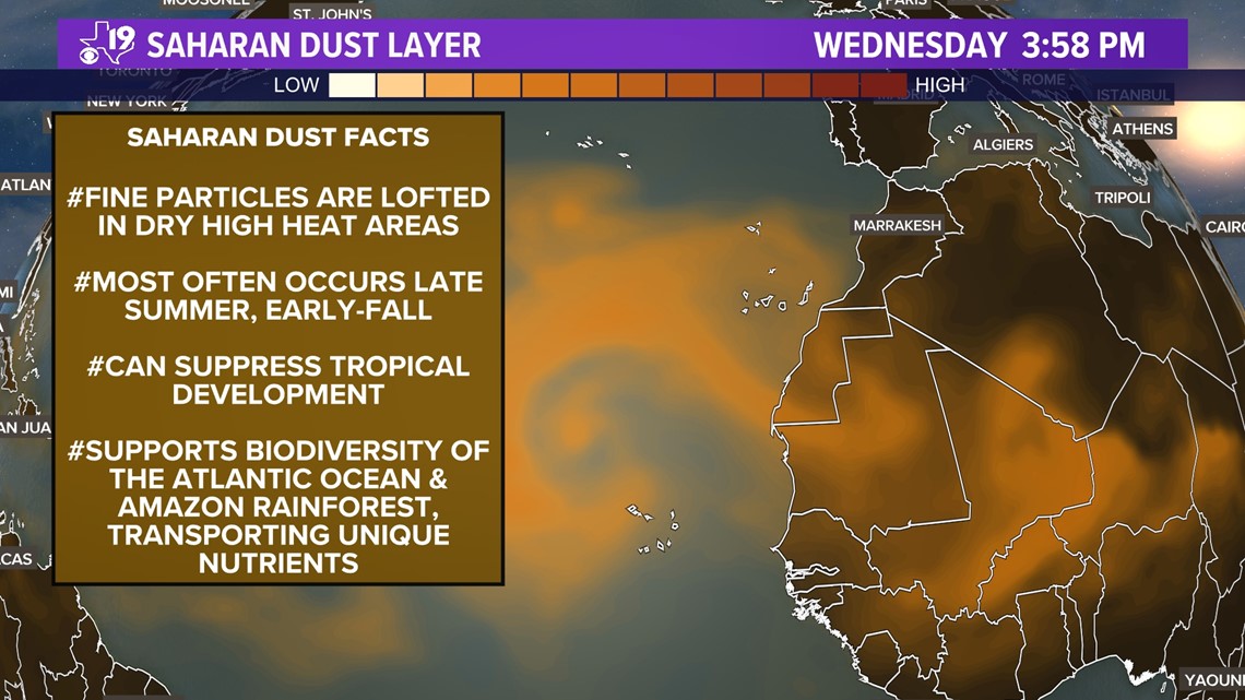
The Saharan Air Layer is the tan shaded area off the west coast of Africa. This is the layer, or air, driving the dust plume across the Atlantic and is about a mile above the surface. The SAL stays there due in part to strong winds, very dry air, and very warm temperatures.
These elevated dust clouds can suppress tropical storm and hurricane development in the Atlantic and Gulf of Mexico. Using the same AOT data, we are able to forecast where the SAL is headed.
One dust plume is forecast to arrive into parts of East Texas by Sunday:

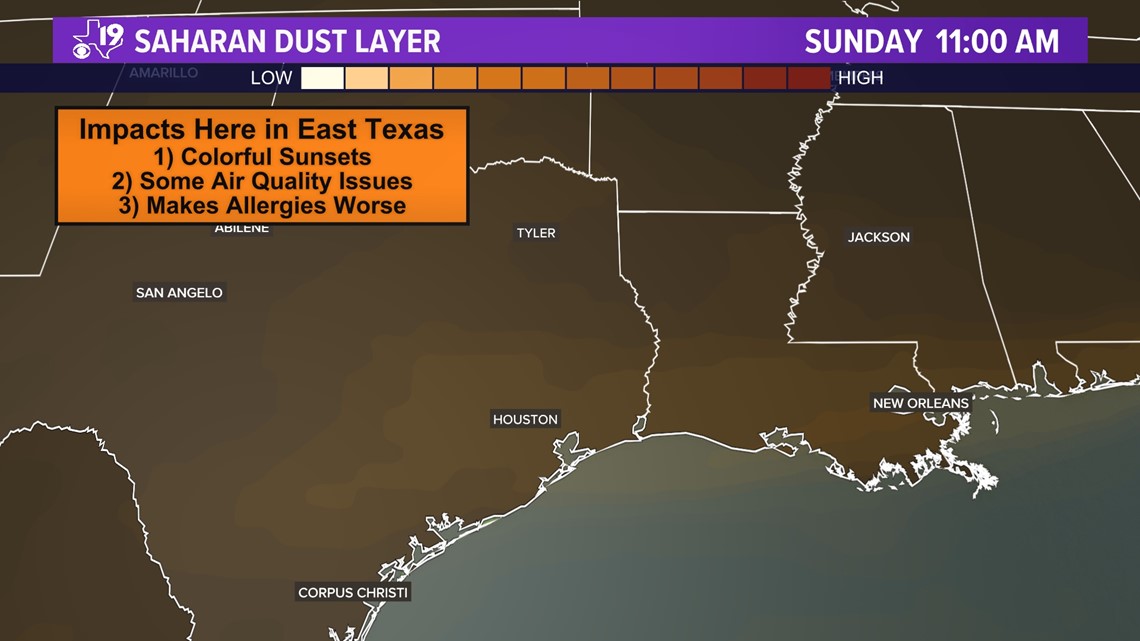
The plume currently off the west coast of Africa is thicker and should remain thicker as it arrives in East Texas next week. If you are sensitive to air quality, you may notice some added difficulty in breathing and some of us will have allergy symptoms at a time of the year when we usually don't experience any.
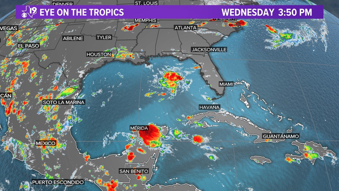
Additionally, there has not been discussion regarding tropical storms or hurricanes this summer. At this point last year, seven storms were named; but this year, only three have been named and one of those formed over land. Below is the outlook today over the tropics, which looks quiet:

The dust doesn't pose any serious threat but on occasions Saharan dust can suppress thunderstorm development, which can cause the sky to remain hazy for days and can lead to hotter temperatures. This leads us to a weekly forecast of highs near 100-degrees for the majority of next week.
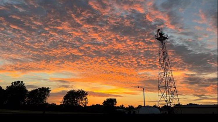
Otherwise, get ready for some colorful sunrises and sunsets. Don't forget: if you snap a picture, share it with us. Either text us 903-600-2600 or email the weather team at weather@cbs19.tv