TYLER, Texas — Happy New Year and I say that with some apprehension. That's because Monday could be a rough day for some of us. Why? Because we have a severe weather threat that could result in some thunderstorm wind or tornado damage.
A lot of "coulds" and "mights" are in there because there are no guarantees we have severe weather, but the potential for severe weather is as high as it was on Nov. 4 and Dec. 13.
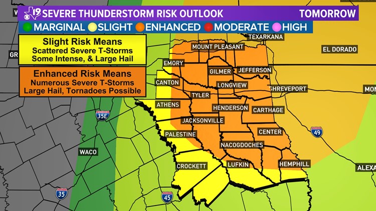
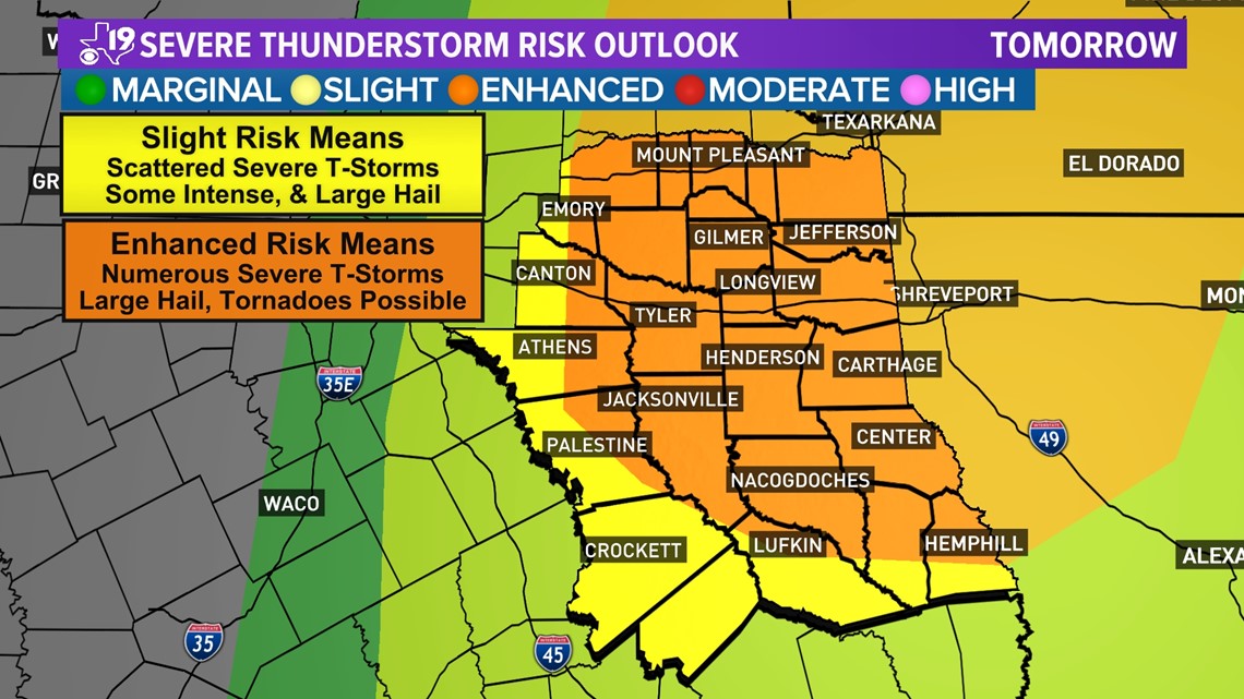
Both of those days produced tornado outbreaks across North Central, Northeast and East Texas. Both days had "Enhanced Outlooks" in East Texas the day before the severe weather hit.
Nov. 4 was upgraded to a "Moderate Risk." At this time, we have an "Enhanced Risk" for severe weather ahead of Monday's thunderstorms.

So, let's be ready and know where we are going to shelter before a tornado watch is issued Monday.
Here's why there is concern for severe weather thunderstorms Monday:
- We've got some juicy air out there. You feel it when you walk outside, it's humid.
- There is a strong storm system with powerful upper-level winds ripping overhead moving in from the west.
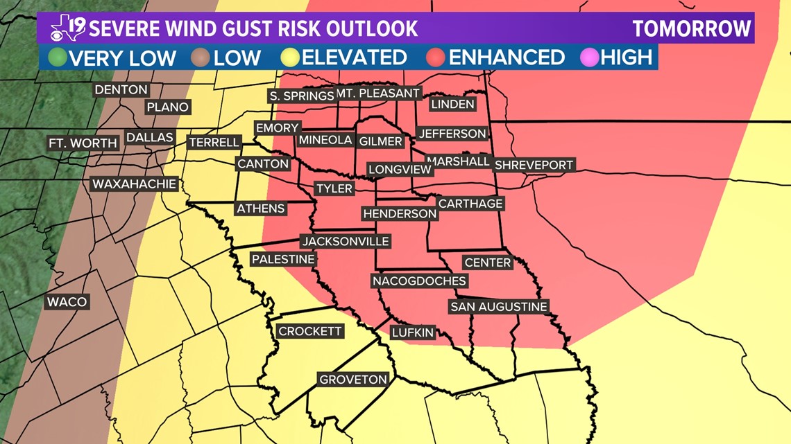
That's important for lift and helping to create a twisting motion in the atmosphere. Closer to the surface the winds are also very strong. Sunday data pointed to forecast wind speeds at around 5,000 ft. in the order of 70+MPH.
These winds are not affected by the Earth's friction and can hint to the power of possible wind gusts if some of these winds sweep downward out of the thunderstorms. Monday, 70+MPH wind gusts will be possible. An Enhanced Damaging Wind gust threat will be over East Texas Monday afternoon and evening.

There is also concern for a couple of strong tornadoes Monday evening, possibly into the nighttime hours. The Storm Prediction Center SPC has outlined a 10% chance area for East Texas.
The area is also hatched meaning within this area, significant tornadoes are possible. By significant, we mean EF2 strength or greater. That means a tornado with wind speeds between 111 and 135 MPH is possible.
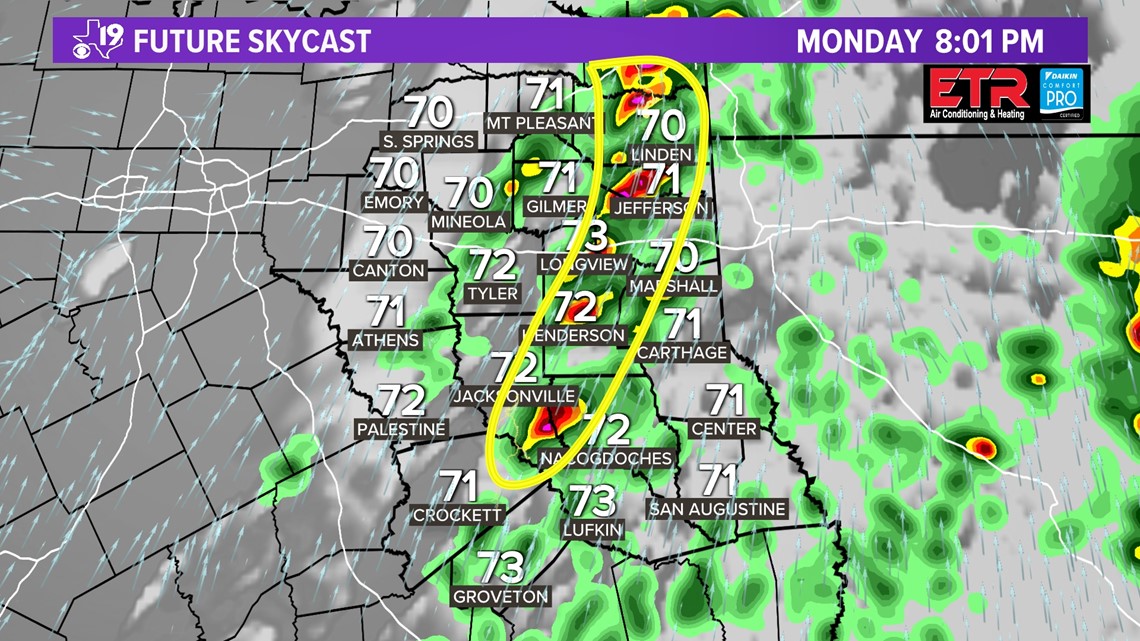
Now let's talk timing. Monday's severe weather event may come at us in two waves. The first severe thunderstorm or tornado warning may be issued late morning for extreme East Texas.

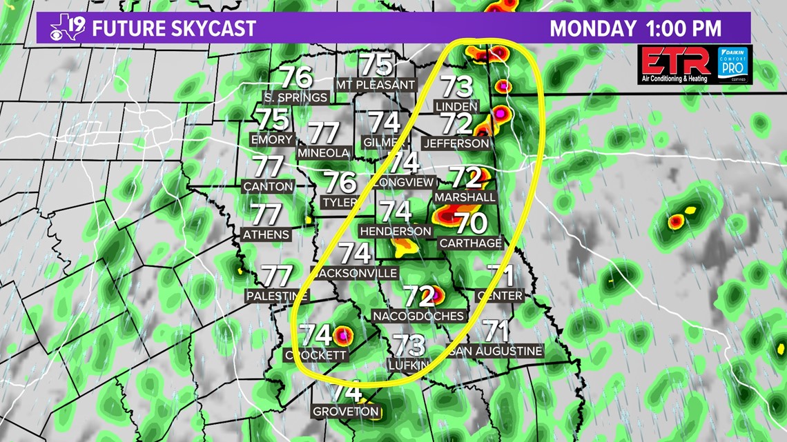
The High-Resolution Rapid Refresh (HRRR) suggests the possibility of some renegade cells developing during the middle of the day.
A strong area of wind shear will be present over East Texas. A brief tornado or a thunderstorm with some large hail will be possible.
Later in the afternoon an area of even stronger wind shear will move in. Add in more warmth and more moisture and the HRRR depicts the possibility of numerous supercells developing in East Texas.

These loner cells will have an environment more friendly for supercell thunderstorms. What makes these cells even more dangerous is that they reach their peak intensity after sunset. This makes them very hard to see.
These are the cells that have the best chance to reach the highest EF-2 intensity. So please take any warnings that are issued tomorrow seriously.
As I said before, please be sure to review your severe weather plan. If you live in a manufactured or mobile home, please make plans to seek shelter elsewhere when a thunderstorm or tornado watch is issued Monday.
One more reminder, make sure to have more than one way to get warnings. Our CBS19 Mobile App will alert you and so will a NOAA weather radio.
Pay attention to radio and tv weather forecasts. Hopefully this will continue to be a happy new year for everyone, and it will be even happier if we can get through Monday safely.